12-70
GTN 725/750 Pilot’s Guide
190-01007-03 Rev. C
Foreword
Getting
Started
Audio &
Xpdr Ctrl
Com/Nav
FPL
Direct-To
Proc
Charts
Wpt Info
Map
Traffic
Terrain
Weather
Nearest
Services/
Music
Utilities
System
Messages
Symbols
Appendix
Index
12.6 FIS-B Weather
The Flight Information Services (FIS-B) function is capable of displaying text
and graphic weather information with GDL 88 installations. No subscription for
FIS-B services is required with the GDL 88.
The FIS-B Function is a graphic weather display capable of displaying
graphical weather information on UAT equipped installations. Graphical data is
overlaid on the map indicating the rainfall detected by ground based radar for a
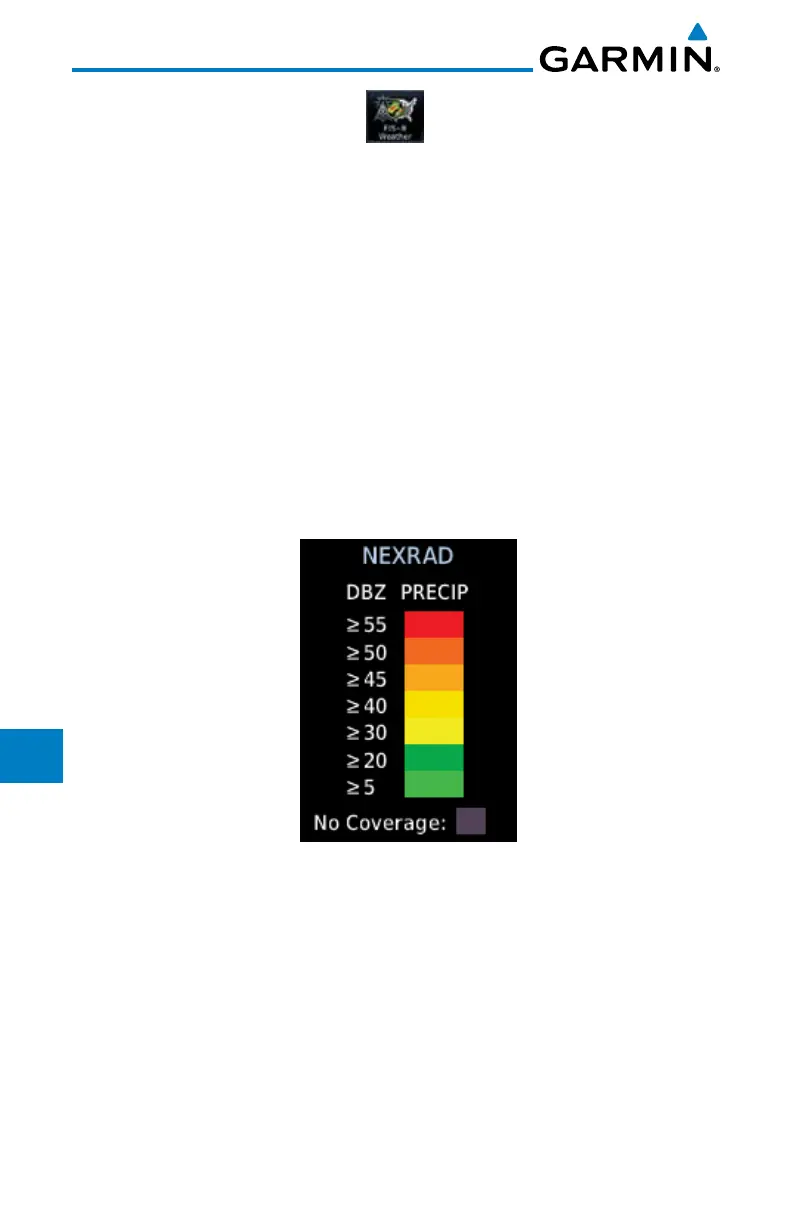
specific area. Colors are used to identify the different NEXRAD echo intensities
(reflectivity) measured in dBZ (decibels of Z). “Reflectivity” (designated by the
letter Z) is the amount of transmitted power returned to the radar receiver.
The dBZ values increase as returned signal strength increases. Precipitation
intensity is displayed using colors corresponding to the dBZ values. Review the
Limitations section in the front of this guide for the limitations that apply to the
FIS-B data. An example of how rainfall data is color coded follows:
Figure 12-88 FIS-B Weather Precipitation Legend
The FIS-B Function is based on a ground-to-air data link and requires that
the appropriate ground systems are broadcasting weather data and the aircraft is
within reception range of the Ground Broadcast Transceiver (GBT).

 Loading...


