12-79190-01007-03 Rev. C
GTN 725/750 Pilot’s Guide
Foreword
Getting
Started
Audio &
Xpdr Ctrl
Com/Nav
FPL
Direct-To
Proc
Charts
Wpt Info
Map
Traffic
Terrain
Weather
Nearest
Services/
Music
Utilities
System
Messages
Symbols
Appendix
Index
12.6.4 FIS-B METARs
When enabled, graphic METARs (METeorological Aviation Reports) are
shown as colored flags at airports that provide METAR reports. Press the
METARs key to enable or disable METARs. Refer to the Legend for a description
of the color code. The update rate is every five minutes.
METAR Symbol Description
VFR (ceiling greater than 3000 ft. AGL and
visibility greater than five miles)
Marginal VFR (ceiling 1000–3000 ft. AGL
and/or visibility three to five miles)
IFR (ceiling 500 to below 1000 ft. AGL and/or
visibility one mile to less than three miles)
Low IFR (ceiling below 500 ft. AGL or visibility
less than one mile)
Unknown
Table 12-9 METAR Symbols
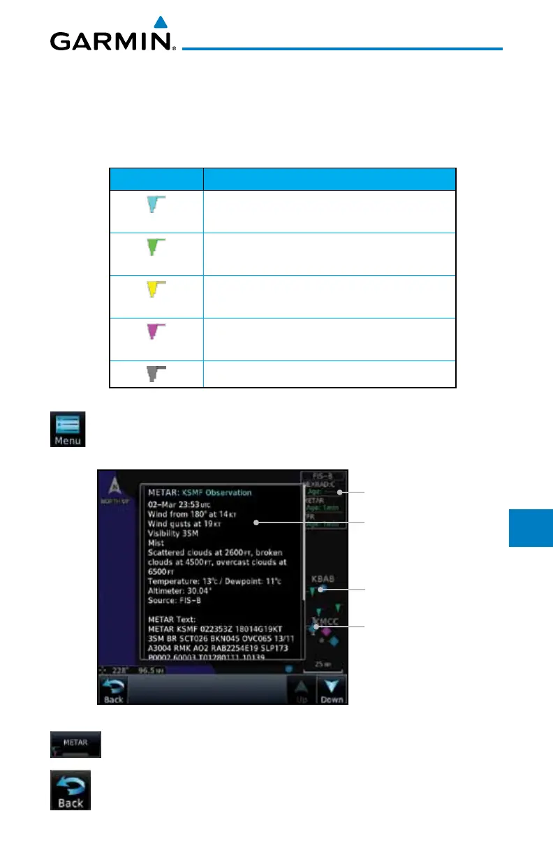
1. While viewing the FIS-B weather page, touch the Menu key
to select the METAR choice. Touch an airport symbol for more
METAR detail.
Touch Airport For
METAR Detail
Product Age
METAR Flags
METAR Detail
Figure 12-98 METARS
2. Touch the METAR key to toggle METARS on or off.
3. Touch the Back key to return to the FIS-B Weather page.

 Loading...


