10-15190-01007-03 Rev. C
GTN 725/750 Pilot’s Guide
Foreword
Getting
Started
Audio &
Xpdr Ctrl
Com/Nav
FPL
Direct-To
Proc
Charts
Wpt Info
Map
Traffic
Terrain
Weather
Nearest
Services/
Music
Utilities
System
Messages
Symbols
Appendix
Index
10.4.2.2 Range Ring
Touching the In and Out keys will zoom in and out in preset steps depending
on the installed equipment as shown in the following table.
Traffic Device Map Ranges
Garmin GTS 800, Skywatch (SKY497/
SKY889)
2 NM, 6 NM, 12 NM
Garmin GTS 820 and 850, Honeywell
KTA 810 TAS, KTA 910 TAS, KMH
820 IHAS, KMH 920 IHAS, and
Avidyne TAS 620 (Ryan 9900BX)
2 NM, 6 NM, 12 NM, 24 NM, 40 NM
Table 10-7 Available Traffic Range Ring Steps
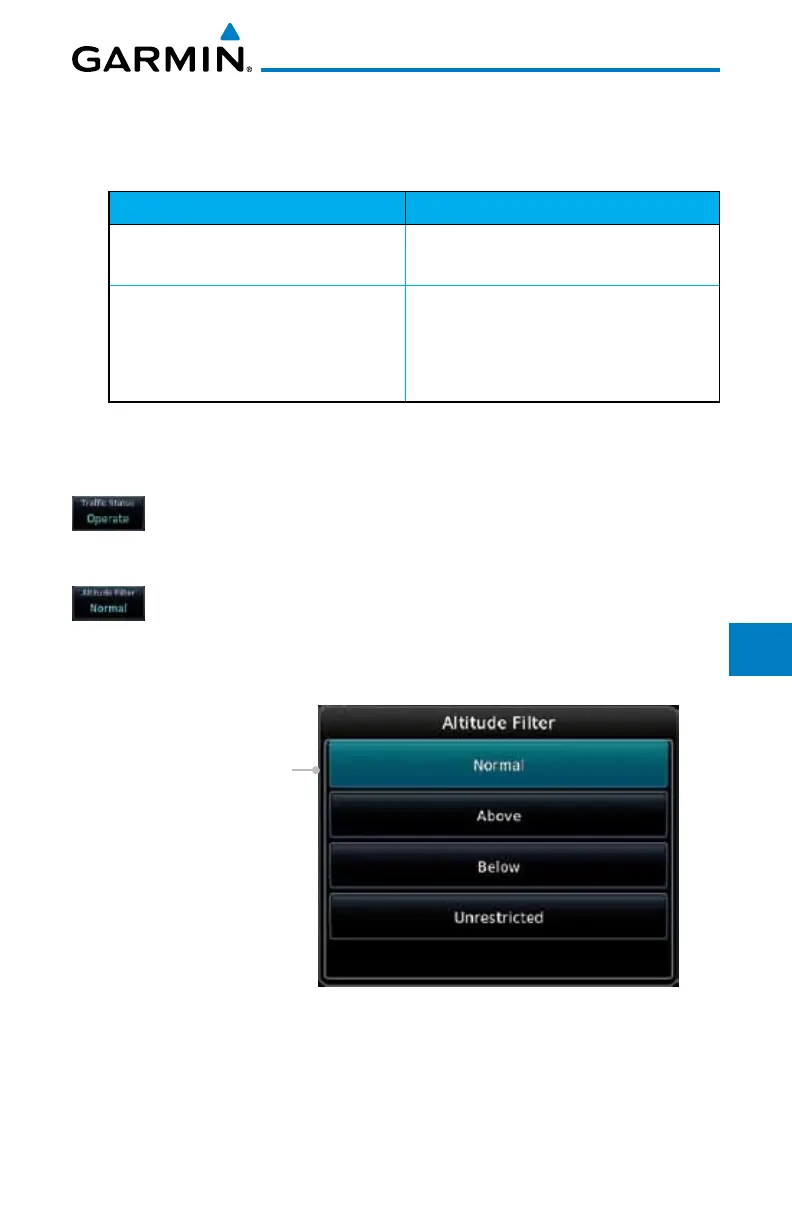
10.4.3 Altitude Display
1. While viewing the Traffic page, touch the Traffic Status key
to begin displaying traffic. “TAS OPERATING” is displayed in
the Traffic mode field.
2. Touch the Altitude Filter key to change the altitude volume.
Select
the desired altitude volume by touching the
BELOW,
NORMAL, ABOVE, or UNRESTRICTED keys. The selection
is displayed in the Altitude mode field.
Selected Altitude Filter
Figure 10-9 Traffic Altitude Filter Page

 Loading...


