8-4
GTN 725/750 Pilot’s Guide
190-01007-03 Rev. C
Foreword
Getting
Started
Audio &
Xpdr Ctrl
Com/Nav
FPL
Direct-To
Proc
Charts
Wpt Info
Map
Traffic
Terrain
Weather
Nearest
Services/
Music
Utilities
System
Messages
Symbols
Appendix
Index
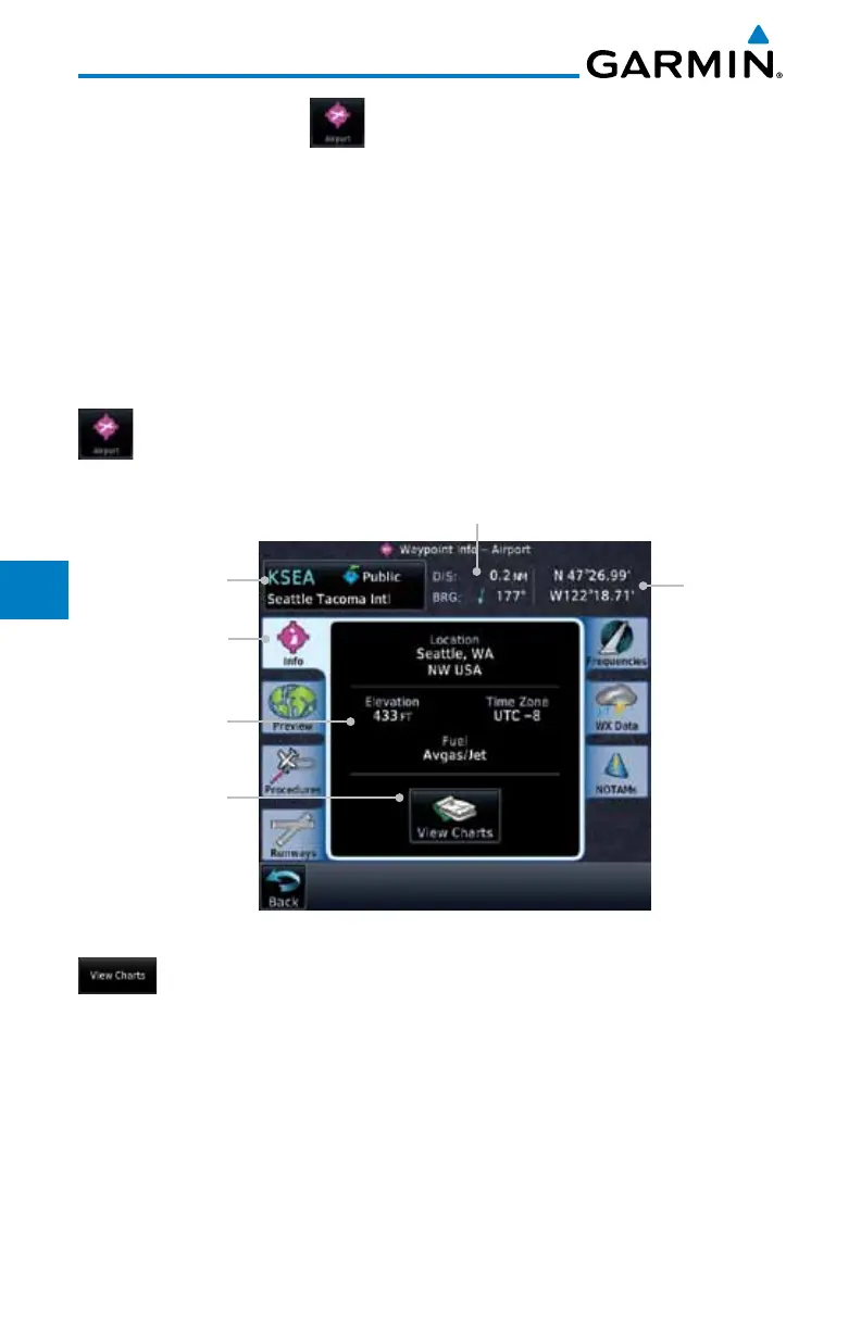
8.2 Airport
The Airport page of the Waypoint Info function provides a variety of detailed
information about the airport.
8.2.1 Info
The upper part of the page shows the airport identifier and type, name, city
and region, the lat/lon coordinates of the airport, and the bearing (and direction
arrow) and distance to the airport from your present position. The center area
shows the airport elevation, fuel availability, and time zone.
1. While viewing the Waypoint Info page, touch the Airport
key.
Distance & Bearing To Airport
From Current Position
Waypoint Info
Page Tab
Airport
Identifier, City,
& Type
Airport
Information
Touch To
View Airport
Charts
Airport
Lat/Lon
Figure 8-5 Waypoint Info Airport Page
2.
Touch the View Charts key to display available charts for the airport.

 Loading...


