9-21190-01007-03 Rev. C
GTN 725/750 Pilot’s Guide
Foreword
Getting
Started
Audio &
Xpdr Ctrl
Com/Nav
FPL
Direct-To
Proc
Charts
Wpt Info
Map
Traffic
Terrain
Weather
Nearest
Services/
Music
Utilities
System
Messages
Symbols
Appendix
Index
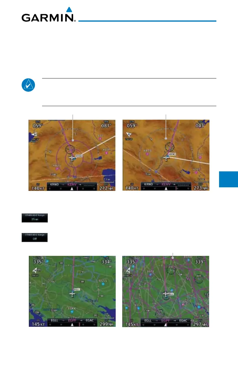
Smart Airspaces:
Garmin’s Smart Airspace™ feature aids visual clarity on-screen by de-
emphasizing airspace that’s well above or below the aircraft’s current altitude.
The vertical separation is 1000 feet at sea level and the vertical separation will
gradually increase to 2000 feet until the aircraft reaches 10,000 feet. Anything
above 10,000 feet keeps the 2000 feet vertical separation.
NOTE: Smart Airspace only changes the depiction of the airspace on the
moving map display. It does not alter the Airspace Alerts that can be set
on the System-Alerts portion of the system.
Smart Airspaces - OnSmart Airspaces - Off
Figure 9-25 Display of Smart Airspaces (Airspace Borders Grayed)
To control the display of European airway airspaces:
1. While viewing the Map Setup Airspaces option, touch the
Other/ADIZ Range key and select a value.
2. Select Off for the Other/ADIZ Range to turn off the display of
airway airspaces.
Airway Airspaces - On
Airway Airspaces - OnAirway Airspaces - Off
Figure 9-26 Selecting the Display of European Airway Airspaces

 Loading...


