11-3190-01007-03 Rev. C
GTN 725/750 Pilot’s Guide
Foreword
Getting
Started
Audio &
Xpdr Ctrl
Com/Nav
FPL
Direct-To
Proc
Charts
Wpt Info
Map
Traffic
Terrain
Weather
Nearest
Services/
Music
Utilities
System
Messages
Symbols
Appendix
Index
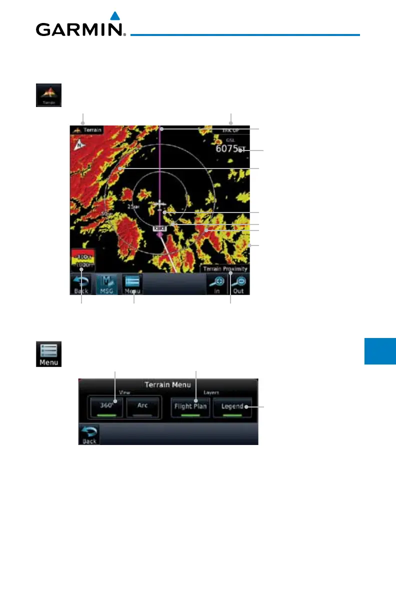
11.2.1 Displaying Terrain Proximity
The Terrain page is in the Terrain function.
1. Touch the Terrain key on the Home page.
Heading Annunciation
Ownship Position
Aircraft GSL Value
(GPS Derived)
Range Rings
Terrain Menu Key
Terrain Page Title
Red Terrain Is Above Or
Within 100 ft Below The
Aircraft Altitude
Yellow Terrain Is Between
100 ft and 1000 ft Below
The Aircraft Altitude
Active Flight Plan Leg
Terrain Type
Terrain Scale
Figure 11-2 Terrain Page
2. Touch the Menu key for options.
Selected View Flight Plan Selected To Show
Terrain Legend
Selected To Show
Figure 11-3 Terrain Menu Options

 Loading...


