12-74
GTN 725/750 Pilot’s Guide
190-01007-03 Rev. C
Foreword
Getting
Started
Audio &
Xpdr Ctrl
Com/Nav
FPL
Direct-To
Proc
Charts
Wpt Info
Map
Traffic
Terrain
Weather
Nearest
Services/
Music
Utilities
System
Messages
Symbols
Appendix
Index
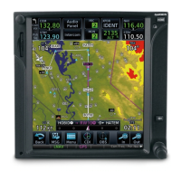
12.6.2 FIS-B NEXRAD
WSR-88D weather surveillance radar or NEXRAD (NEXt generation RADar) is
a Doppler radar system that has greatly improved the detection of meteorological
events such as thunderstorms, tornadoes, and hurricanes. An extensive network
of NEXRAD stations provides almost complete radar coverage of the continental
United States, Alaska, and Hawaii. The unobstructed range of each NEXRAD is
124 nautical miles.
12.6.2.1 NEXRAD Abnormalities
There are possible abnormalities regarding displayed NEXRAD images. Some,
but not all, causes of abnormal displayed information include:
•GroundClutter
•Strobesandspuriousradardata
•Sunstrobes,whentheradarantenna points directly at the sun
•Militaryaircraftdeploymetallicdustwhichcancausealterationsinradar
scans
•Interferencefrombuildingsormountains, which may cause shadows
•Scheduledmaintenancemayputaradaroff-line
12.6.2.2 NEXRAD Limitations
Certain limitations exist regarding the NEXRAD radar displays. Some, but
not all, are listed for the user’s awareness:
• NEXRAD base reectivity does not provide sufficient information to
determine cloud layers or precipitation characteristics (hail vs. rain, etc).
• NEXRADbasereectivityissampledattheminimumantennaelevation
angle. An individual NEXRAD site cannot depict high altitude storms at
close ranges, and has no information about storms directly over the site.
• The resolution of displayed Regional NEXRAD data is approximately
two kilometers and the resolution of displayed CONUS NEXRAD data is
approximately 10 kilometers. Therefore, when zoomed in on the display,
each square block is two kilometers (1.08 NM) or 10 kilometers (5.4 NM)
on a side. The intensity level reflected by the square will be the highest
level sampled within the area covered by each block.
 Loading...


