12-68
GTN 725/750 Pilot’s Guide
190-01007-03 Rev. C
Foreword
Getting
Started
Audio &
Xpdr Ctrl
Com/Nav
FPL
Direct-To
Proc
Charts
Wpt Info
Map
Traffic
Terrain
Weather
Nearest
Services/
Music
Utilities
System
Messages
Symbols
Appendix
Index
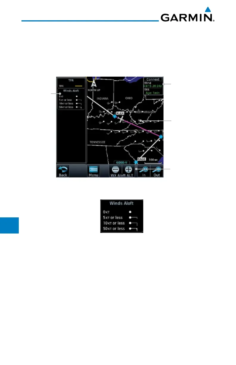
12.5.12 Winds Aloft
Winds Aloft data shows the forecast wind speed and direction at the surface
and at selected altitudes. Altitudes can be selected in 3000 foot increments from
the surface up to 42,000 feet MSL. Pressing the WX Aloft ALT + or – soft keys
steps down or up in 3,000 foot increments.
Product Age
Winds Aloft
Altitude Selection
Winds Aloft
Symbol
Winds Aloft
Legend
Figure 12-84 Connext Weather - Winds Aloft
Figure 12-85 Connext Weather - Winds Aloft Legend
Winds Aloft Altitude
The Winds Aloft Altitude option allows you to select the altitude for the
Winds Aloft weather product. Altitude can be selected in 3,000 foot increments
from the surface up to 42,000 feet MSL.
Pressing the WX Aloft ALT + or – soft keys steps down or up in 3,000 foot
increments. In the figure shown above, 6,000 feet is selected and Winds Aloft
data is shown for winds reported at an altitude of 6,000 feet.

 Loading...


