AP1.2 Configuration of NMEA Ver-3.00 Sentence
AP1-6
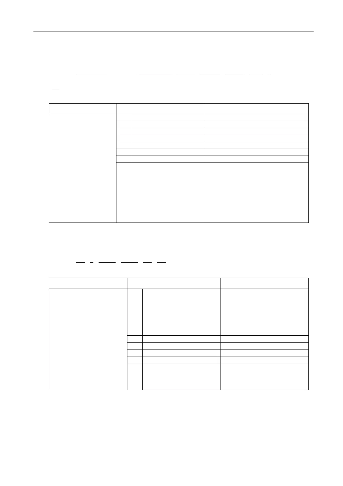
1.2.3 BWR - Bearing and distance to waypoint - rhumb line
$--BWR, hhmmss.ss , llll.lll , a , yyyyy.yy, a , x.x , T , x.x , M , x.x , N , c—c , a
1 2 3 4 5 6 7 8
*hh<CR><LF>
Contents Data Note
1 UTC of observation
2 Waypoint latitude, N/S
3 Waypoint longitude, E/W
4 Bearing, degrees true
5 Bearing, degrees magnetic
6 Distance, nautical miles
7 Way point ID Not used
Bearing and distance to
waypoint – rhumb line
Time (UTC) and distance
and bearing to,
and location of,
specified waypoints from
present position.
BWR data is calculated
along the rhumb line
from present position
rather than along the great
cirele path.
8 Mode indicator
Positioning system Mode indicator:
A= Autonomous mode
D= Differential mode
E= Estimated (dead reckoning) mode
M= Manual input mode
S= Simulator mode
N= Data not valid
The position system Mode indicator field
shall not be a null field.
1.2.4 DTM - Datum reference
$--DTM, ccc , a , x.x , a , x.x , a , x.x , ccc *hh<CR><LF>
1 2 3 4 5 6
Contents Data Note
1 Local datum code
W84= WGS84
W72= WGS72
S85= SGS85
P90= PE90
999= User defined
IHO datum code
2 Local datum subdivision code
3 Lat offset, minutes, N/S
4 Lon offset, minutes, E/W
5 Altitude offset, meters
Datum reference
Local geodetic datum and
datum offset from a reference
datum.
6 Reference datum code
W84= WGS84
W72= WGS72
S85= SGS85
P90= PE90

 Loading...
