10
GPS/GPS-A OPERATION
10-6
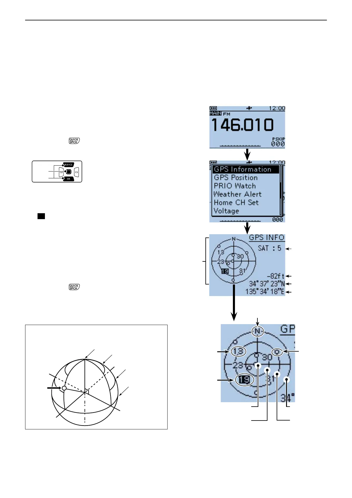
This screen is used to receive GPS satellite when the
GPS indicator does not stop blinking for a long time.
GPS Information displays the quantity, signal power
and position of the GPS satellites.
Sky view screen shows the position of GPS satellites.
The screen also shows the direction, elevation angle,
satellite numbers and their receiving signal strength
status.
Push [QUICK] q .
Push D-pad( w ) to select “GPS Information,” and
then push D-pad(Ent).
Meaning of the indications
•() : Untracking satellite.
•(01) :Trackingsatellitewithaweaksignalshown
in satellite number.
•(
01
) : Tracking satellite with a strong signal
shown in satellite number.
•(SAT) :Thequantityoftrackingsatellites.
•Altitude:Thealtitudeofyourstation.
The altitude is only displayed when more
than 4 satellites are tracked. When less
than 3 satellites are tracked, [------ft] is
displayed.
•Longitude/Latitude
:LongitudeandLatitudeofyourstation.
Push [QUICK] e
to exit the GPS INFO screen.
Elevation angle
30 degree line
Elevation angle
60 degree line
Elevation angle 90 degree
line (Zenith)
• The image of the satellite number 23
■ Checking GPS Information (Sky view screen)
Elevation angle
0 degree line
Sky view
screen
Latitude
Tracking satellite
quantity
Altitude
Longitude
Untracking
satellite
Satellite number
19’s signal is
strong.
Satellite number
13’s signal is
weak.
Elevation angle
0 degree line
Elevation angle
30 degree line
Elevation angle
60 degree line
Elevation angle 90
degree line (Zenith)
North
Satellite
number
23
 Loading...