Garmin G300 Pilot’s Guide
190-00921-00 Rev. D 83
GPS Navigation
System
Overview
Flight
Instruments EIS
COM
Interface
GPS
Navigation
Flight
Planning
Hazard
Avoidance
Additional
Features
Integrated
Autopilot Annun/Alerts Appendix Index
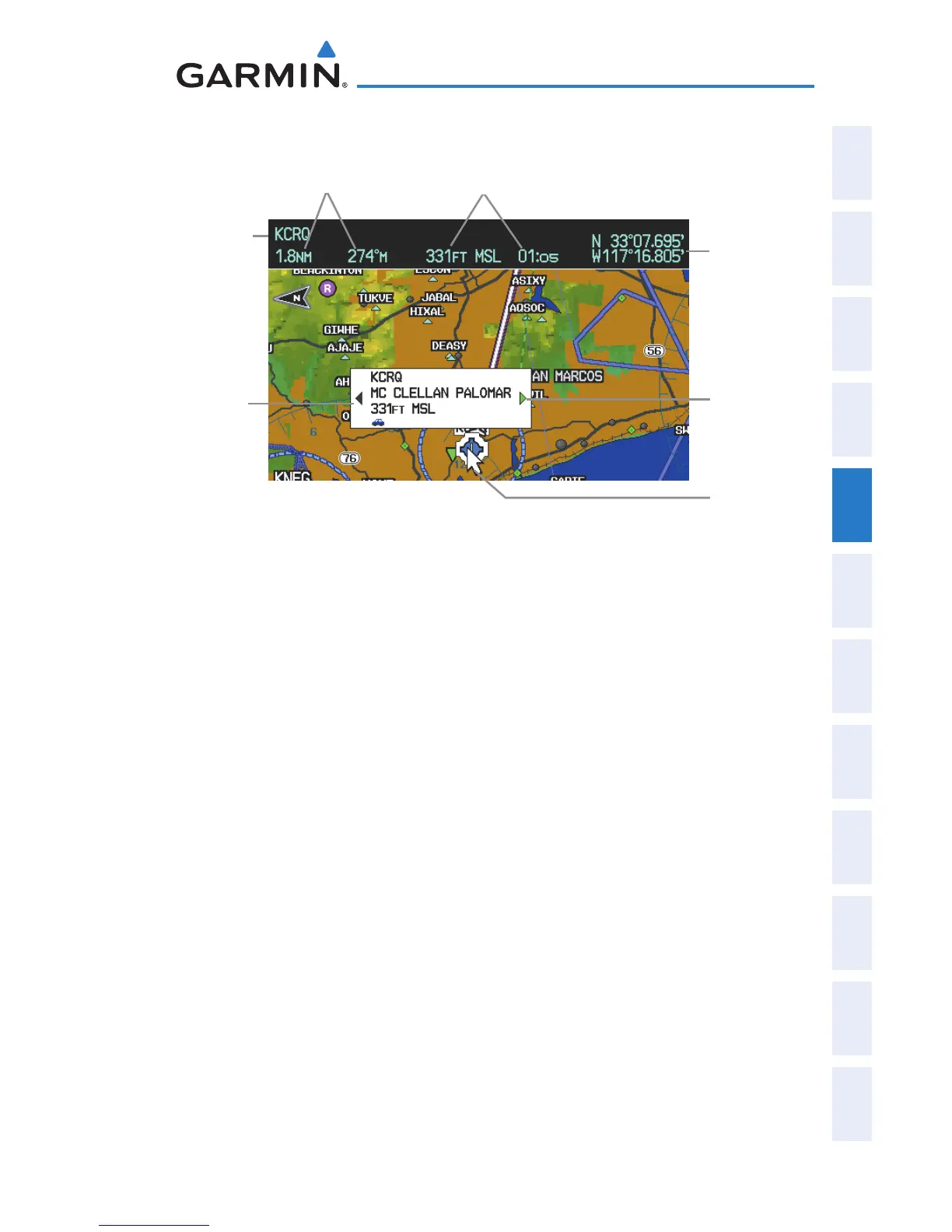
Map Panning (Map Page)
Infor-
mation
Box
Map Pointer
Bearing and Dis-
tance to the Pointer
from the Aircraft’s
Present Position
Elevation and ETE
to the Pointer
Green Arrow
Indicating
Multiple
Features are
Present at the
Map Pointer
Location.
Latitude/
Longitude
Position of
the Pointer
Pointer
Location
(Name)
Panning the map:
1)
Press the FMS Joystick (or PAN MAP Softkey on the Weather (WX)
Page) to display the Map Pointer.
2)
Move the FMS Joystick to move the Map Pointer around the map.
3)
Press the FMS Joystick to remove the Map Pointer and re-center the
map on the aircraft’s current position.
Reviewing information for a map feature:
1)
Place the Map Pointer on a map feature. If multiple map features are
present at the Map Pointer position (green arrow in the information
box), turn the FMS Joystick to cycle through the list.
2)
Press the ENT Key to display the review page for the highlighted
feature.
3)
Press the FMS Joystick, the CLR Key, or the ENT Key to exit the review
page and return to the Map Page showing the selected waypoint.

 Loading...


