Garmin G300 Pilot’s Guide
190-00921-00 Rev. D
142
Hazard Avoidance
System
Overview
Flight
InstrumentsEIS
COM
Interface
GPS
Navigation
Flight
Planning
Hazard
Avoidance
Additional
Features
Integrated
AutopilotAnnun/AlertsAppendixIndex
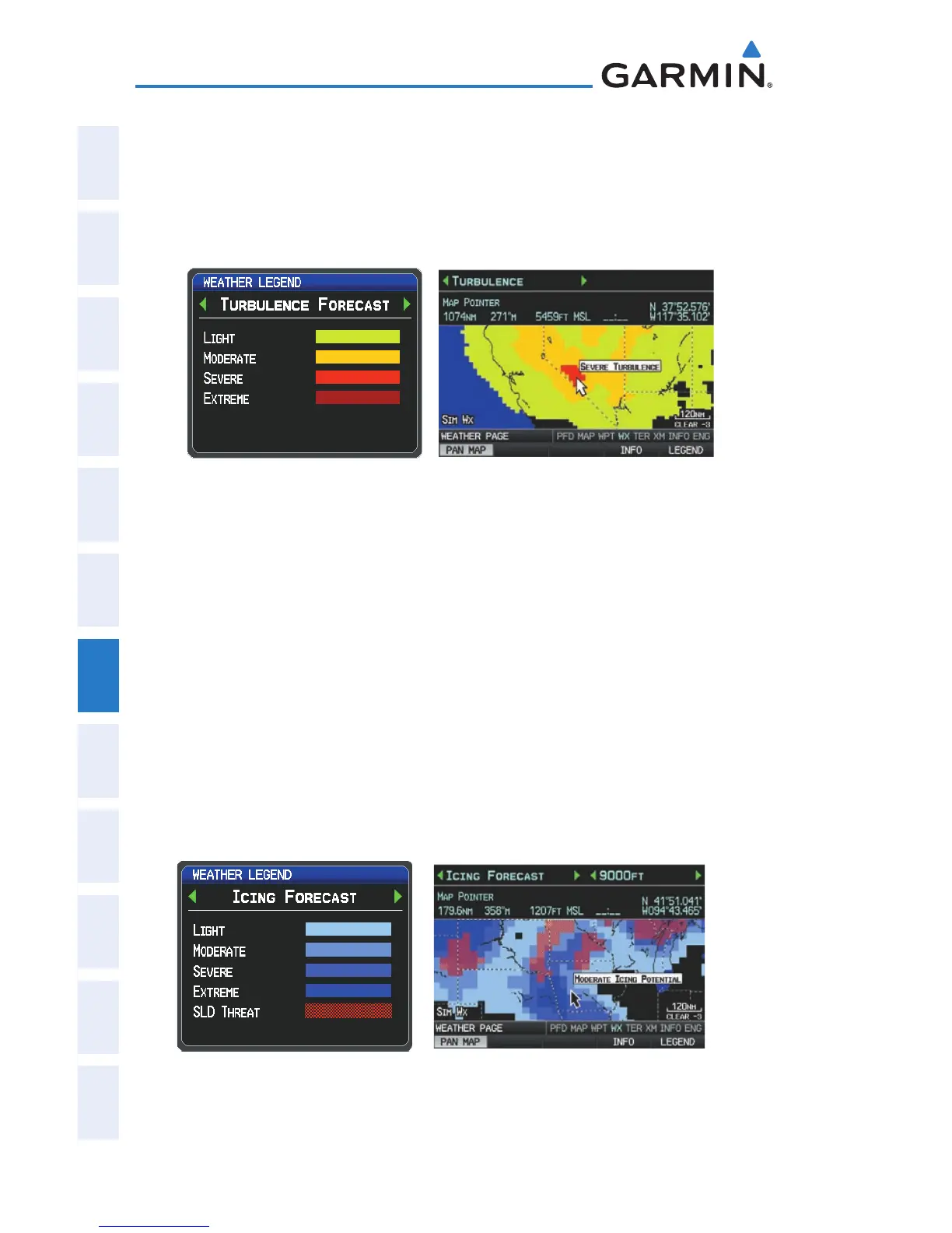
TURBULENCE FORECAST
Turbulence data identifies the potential for erratic movement of high-altitude
air mass associated winds. Turbulence is classified as light, moderate, severe, or
extreme. Turbulence data is intended to supplement AIRMETs and SIGMETs.
Severe Turbulence Selected With Map
Pointer (Single Display)
Turbulence Forcast Legend
ICING FORECAST (CIP & SLD)
Current Icing Product (CIP) data shows a graphical view of the current icing
environment. Icing severity is displayed in four categories: light, moderate, severe,
and extreme (not specific to aircraft type). The CIP product is not a forecast, but a
representation of the current conditions at the time of the analysis.
Supercooled Large Droplet (SLD) icing conditions are characterized by the
presence of relatively large, super cooled water droplets indicative of freezing
drizzle and freezing rain aloft. SLD threat areas are depicted as magenta dots
over the CIP colors.
Moderate Icing Selected With Map Pointer
(Single Display)
Icing Forcast Legend

 Loading...


