Garmin G300 Pilot’s Guide
190-00921-00 Rev. D
88
GPS Navigation
System
Overview
Flight
InstrumentsEIS
COM
Interface
GPS
Navigation
Flight
Planning
Hazard
Avoidance
Additional
Features
Integrated
AutopilotAnnun/AlertsAppendixIndex
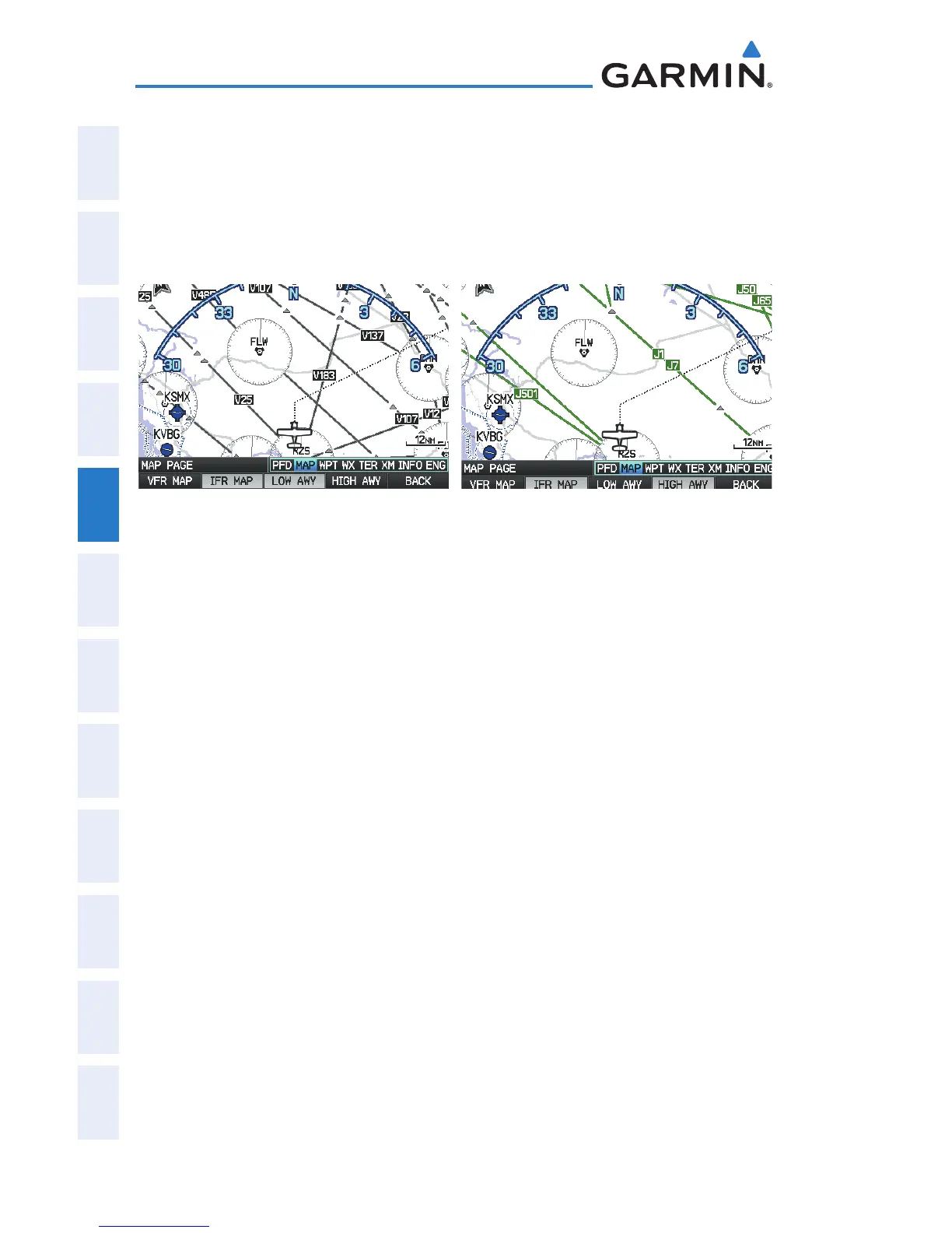
Low Altitude Airways are drawn in gray. High Altitude Airways are drawn in
green. When both types of airways are displayed, high altitude airways are drawn
on top of Low Altitude Airways.
When airways are selected for display on the map, the airway waypoints (VORs,
NDBs, and Intersections) are also displayed.
IFR Map - Low Airways (Victor Airways)
(Single Display)
IFR Map - High Airways (Jet Routes)
(Single Display)
Airways may be displayed on the map at the pilot’s discretion using the MAP
Softkey on the Map Page.
Displaying/removing airways:
1)
Press the MAP Softkey on the Map Page.
2)
Press the IFR MAP Softkey to display the IFR Map and related softkeys.
3)
Press the LOW AWY Softkey to display/remove the Low Altitude
Airways.
4)
Press the HIGH AWY Softkey to display/remove the High Altitude
Airways.
5)
Press the BACK Softkey to return to the top-level softkeys.
Reviewing information for an airway:
1)
From the Map Page, press the MAP Softkey.
2)
Press the IFR MAP Softkey (if necessary).
3)
With the LOW AWY and/or HIGH AWY Softkeys selected, press the
FMS Joystick to display the Map Pointer.
4)
Place the Map Pointer on an airway. The MEA, name of airway,
endpoints, distance, and calculated radials are displayed.

 Loading...


