Garmin G300 Pilot’s Guide
190-00921-00 Rev. D
98
GPS Navigation
System
Overview
Flight
InstrumentsEIS
COM
Interface
GPS
Navigation
Flight
Planning
Hazard
Avoidance
Additional
Features
Integrated
AutopilotAnnun/AlertsAppendixIndex
3)
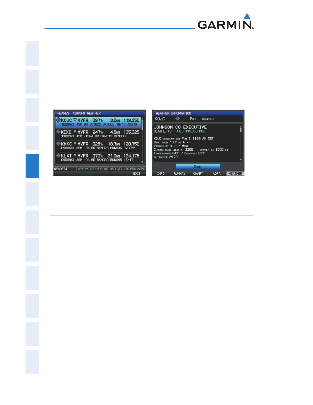
Press the FMS Joystick to highlight the first airport in the nearest
airport weather list. Turn or move the FMS Joystick to highlight the
desired airport weather.
4)
Press the ENT Key to display the Weather Information Page.
5)
Turn the FMS Joystick to scroll up or down on the page.
6)
To return to the Nearest Airport Weather Page, press the FMS Joystick,
the ENT Key, or the CLR Key.
Nearest Airport Weather Page
(Single Display)
Weather Information Page
(Single Display)
INTERSECTIONS
Intersections can be viewed from the Waypoint Page or the Nearest Intersections
Page. In addition to displaying a map of the currently selected intersection and
surrounding area, the Intersection Information Page displays the region, bearing,
distance, latitude, and longitude.
Selecting a intersection:
1)
From the Waypoint Page, press the INFO Softkey.
2)
Press the FMS Joystick to activate the cursor.
3)
Turn the FMS Joystick clockwise to begin entering an intersection
identifier (turning it counter-clockwise brings up the waypoint selection
submenu - press the CLR Key or the FMS Joystick to remove it), or
move the FMS Joystick to select the facility name, or city field.
4)
Press the ENT Key.
Or
:

 Loading...


