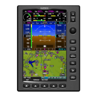
Garmin G300 Pilot’s Guide
190-00921-00 Rev. D
Appendix A
215
System
Overview
Flight
Instruments EIS
COM
Interface
GPS
Navigation
Flight
Planning
Hazard
Avoidance
Additional
Features
Integrated
Autopilot Annun/Alerts Appendix Index
SECTION 11 APPENDICES
APPENDIX A: DATA FIELD OPTIONS
DATA BAR FIELD OPTIONS
Data Bar Field Definition
BRG - Bearing to Waypoint
The compass direction from the present position
to the next waypoint.
DA - Density Altitude
Pressure altitude corrected for non-standard
temperature variations.
DST - Distance to Waypoint
The distance to the next waypoint in the Active
Flight Plan.
DTK - Desired Track
The desired course between the active “from”
and “to” waypoints.
ESA - En Route Safe Altitude
The recommended minimum altitude within ten
miles left or right of the desired course on an
active flight plan or direct-to.
ETA - Estimated Time of
Arrival
The estimated time at which the aircraft should
reach the next waypoint, based upon current
ground speed and track.
ETE - Estimated Time En
Route
The estimated time it takes to reach the next
waypoint from the present position, based upon
current ground speed.
GS - Ground Speed
The velocity that the aircraft is traveling relative
to a ground position.
LCL - Time of Day(Local)
The current time and date in 12-hour or
24-hour format.
MACH - Mach Number
A unit of speed that measures the ratio of the
speed of an airplane to the speed of sound in
the same atmospheric conditions.
MSA - Minimum Safe
Altitude
Uses Grid MORAs to determine a safe altitude
within ten miles of the aircraft’s present
position.
 Loading...