Garmin G300 Pilot’s Guide
190-00921-00 Rev. D
86
GPS Navigation
System
Overview
Flight
InstrumentsEIS
COM
Interface
GPS
Navigation
Flight
Planning
Hazard
Avoidance
Additional
Features
Integrated
AutopilotAnnun/AlertsAppendixIndex
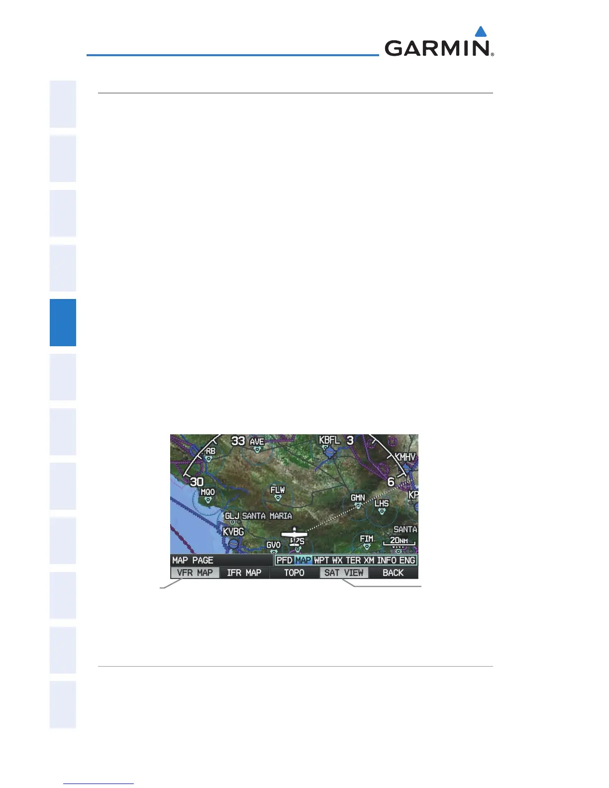
SATELLITE VIEW
The Satellite View displays satellite imagery above 20nm.
Displaying/removing satellite imagery on the map page:
1)
Press the MAP Softkey on the Map Page. Press the VFR MAP Softkey
(if necessary).
2)
Press the SAT VIEW Softkey. Satellite imagery is displayed on the
map.
3)
Press the SAT VIEW Softkey again to remove satellite imagery from
the Navigation Map.
Or
:
1)
From the Map Page, press the MENU Key.
2)
Turn or move the FMS Joystick to highlight ‘Set Up Map’, and press the
ENT Key.
3)
Turn the FMS Joystick to highlight the ‘Map’ Category from the
horizontal list.
4)
Move the FMS Joystick to highlight the ‘Satellite View’ field.
5)
Turn the FMS Joystick to select ‘On’ or ‘Off’, and press the ENT Key.
Satellite View (Map Page)
(Single Display)
SAT VIEW
Softkey
VFR MAP
Softkey
MAP SYMBOLS
Refer to Appendix F for a list of map symbols.

 Loading...


