Garmin G300 Pilot’s Guide
190-00921-00 Rev. D
150
Hazard Avoidance
System
Overview
Flight
InstrumentsEIS
COM
Interface
GPS
Navigation
Flight
Planning
Hazard
Avoidance
Additional
Features
Integrated
AutopilotAnnun/AlertsAppendixIndex
3)
Turn the FMS Joystick to highlight the ‘Map’ Category from the
horizontal list.
4)
Move the FMS Joystick to highlight the ‘Terrain Shading’ field.
5)
Turn the FMS Joystick to select ‘On’ or ‘Off’, and press the ENT Key.
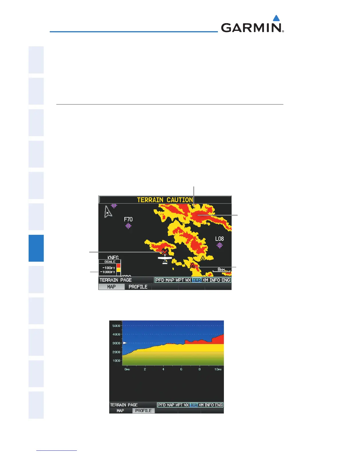
TERRAIN VIEWS
Two views are displayed on the Terrain (TER) Page: the Map View, and the
Profile View.
Press the
MAP
or
PROFILE
Softkeys to toggle between views (single display
only).
Terrain (TER) Page (Map View) (Single Display)
Yellow Terrain is Between the
User-defined Caution Elevation
and 100 ft Below the Aircraft
Potential
Impact
Point
Terrain
Legend
Red Terrain
is above the
aircraft, or
within 100
ft below the
aircraft.
Obstacle
Terrain (TER) Page (Profile View) (Single Display)

 Loading...


