Garmin G300 Pilot’s Guide
190-00921-00 Rev. D 135
Hazard Avoidance
System
Overview
Flight
Instruments EIS
COM
Interface
GPS
Navigation
Flight
Planning
Hazard
Avoidance
Additional
Features
Integrated
Autopilot Annun/Alerts Appendix Index
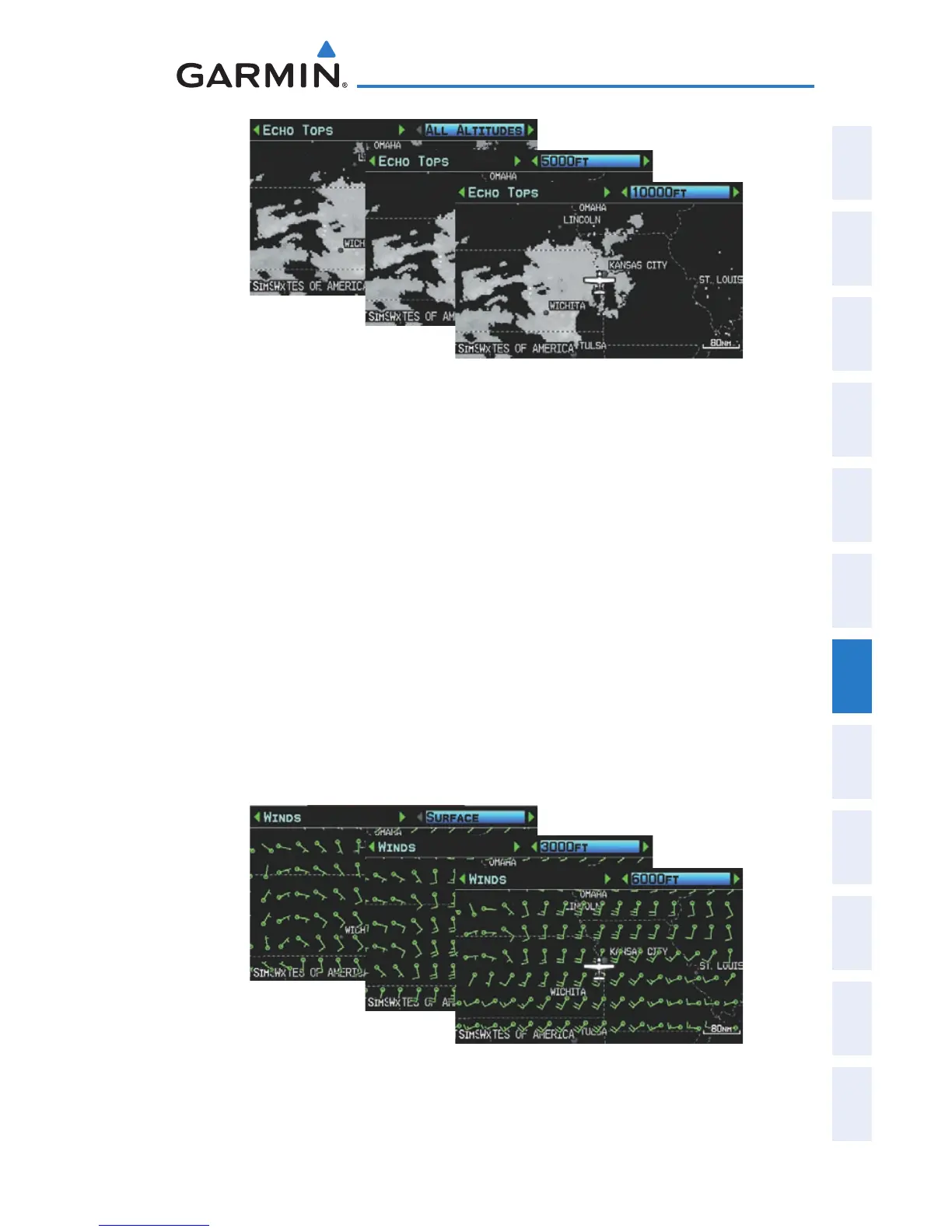
Echo Tops Data (Single Display)
WINDS ALOFT
Winds Aloft data shows the forecasted wind speed and direction at the surface
and at selected altitudes. Altitudes can be displayed in 3,000-foot increments up
to 42,000 feet MSL.
Winds Aloft are displayed using wind barbs or a wind streamline depending on
the selected range. The wind barbs indicate wind speed and direction. The wind
streamline indicates wind direction with arrows.
The wind barbs always point in the direction that the wind is coming from. The
wind speed is depicted using flags at the end of the wind barb. A short wind flag
is 5 knots, a long wind flag is 10 knots, and a triangle flag is 50 knots.
Winds Aloft Data (Single Display)

 Loading...


