Garmin G300 Pilot’s Guide
190-00921-00 Rev. D 51
Flight Instruments
System
Overview
Flight
Instruments EIS
COM
Interface
GPS
Navigation
Flight
Planning
Hazard
Avoidance
Additional
Features
Integrated
Autopilot Annun/Alerts Appendix Index
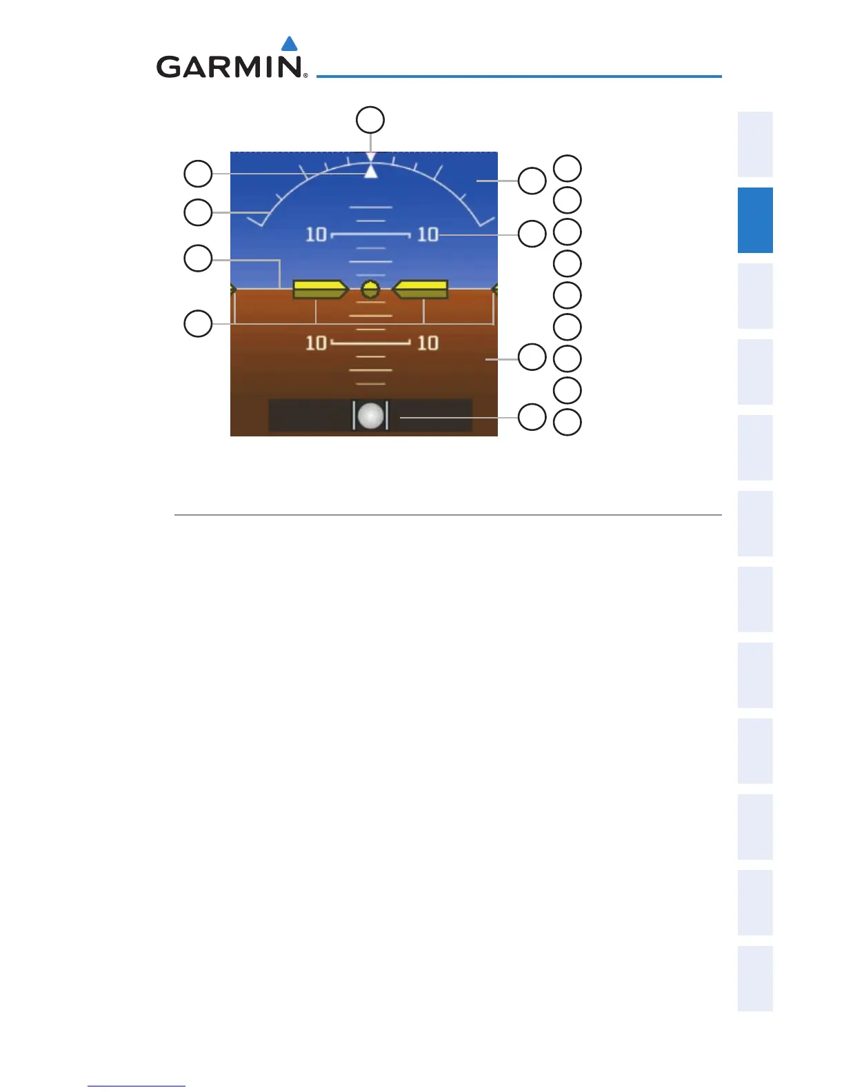
Attitude Indicator
1
Roll Pointer
2
Roll Scale
3
Horizon Line
4
Aircraft Symbol
5
Slip/Skid Indicator
6
Land Representation
7
Pitch Scale
8
Sky Representation
9
Roll Scale Zero
5
6
8
7
2
4
3
9
1
ALTIMETER
The Altimeter displays 400 feet of barometric altitude values at a time on a
rolling number gauge using a moving tape. Numeric labels and major tick marks
are shown at intervals of 100 feet. Minor tick marks are at intervals of 20 feet.
The current altitude is displayed in the black pointer.
The Selected Altitude is displayed above the Altimeter in the box indicated by a
selection bug symbol. A bug corresponding to this altitude is shown on the tape;
if the Selected Altitude exceeds the range shown on the tape, the bug appears at
the corresponding edge of the tape.

 Loading...


