Garmin G300 Pilot’s Guide
190-00921-00 Rev. D
84
GPS Navigation
System
Overview
Flight
InstrumentsEIS
COM
Interface
GPS
Navigation
Flight
Planning
Hazard
Avoidance
Additional
Features
Integrated
AutopilotAnnun/AlertsAppendixIndex
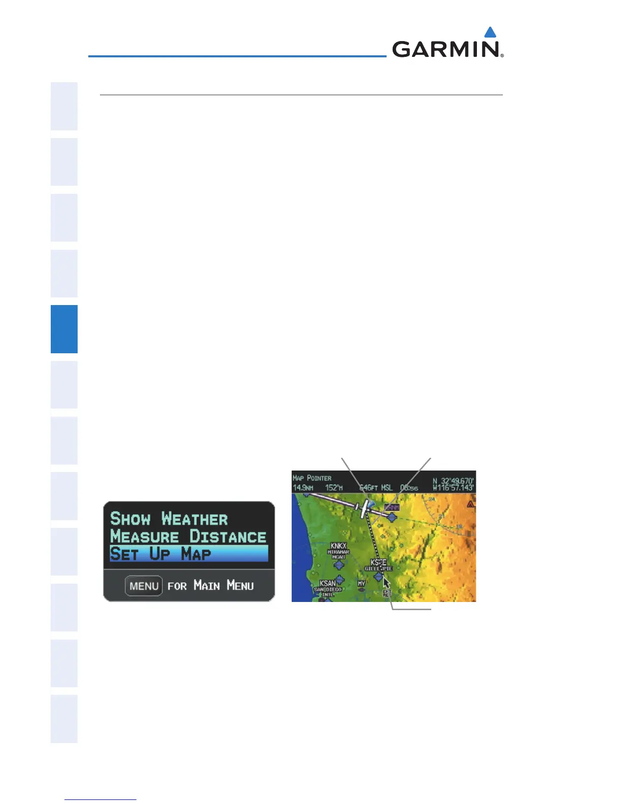
MEASURING BEARING AND DISTANCE
Distance and bearing from the aircraft’s present position to any point on the
viewable navigation map may be calculated using the ‘Measure Distance’ selection
from Map Page menu. The distance tool displays a dashed Measurement Line
and a Map Pointer to aid in graphically identifying points to measure. Lat/Long,
bearing, distance, and elevation data for the Map Pointer is provided in a window
at the top of the Map Page.
Measuring bearing and distance between any two points:
1)
From the Map Page, press the MENU Key.
2)
Turn or move the FMS Joystick to highlight ‘Measure Distance’ and
press the ENT Key. A Measure Pointer is displayed on the map at the
aircraft’s present position.
3)
Move the FMS Joystick to place the reference pointer at the desired
location. The bearing and distance are displayed at the top of the map.
Elevation at the current pointer position is also displayed. Pressing the
ENT Key changes the starting point for measuring.
4)
To exit the Measure Bearing/Distance option, press the FMS Joystick;
or select ‘Stop Measuring’ from the Page Menu and press the ENT Key.
Map Page Menu Map Page (Measure Distance)
Measurement LineReference Point
Map Pointer

 Loading...


