Garmin G300 Pilot’s Guide
190-00921-00 Rev. D
164
Additional Features
System
Overview
Flight
InstrumentsEIS
COM
Interface
GPS
Navigation
Flight
Planning
Hazard
Avoidance
Additional
Features
Integrated
AutopilotAnnun/AlertsAppendixIndex
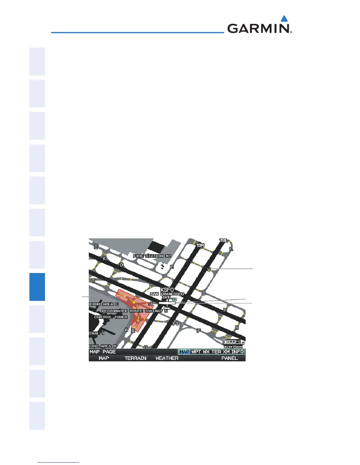
8.2 SAFETAXI
SafeTaxi is an enhanced feature that gives greater map detail when viewing
airports at close range. When viewing at ranges close enough to show the airport
detail, the map reveals taxiways with identifying letters/numbers, runway incursion
“Hot Spots”, and airport landmarks including ramps, buildings, control towers,
and other prominent features. Resolution is greater at lower map ranges. The
SafeTaxi feature can be seen on the Map Page and the Waypoint Page
Designated Hot Spots are recognized at airports with many intersecting
taxiways and runways, and/or complex ramp areas. Airport Hot Spots are outlined
to caution pilots of areas on an airport surface where positional awareness
confusion or runway incursions happen most often. Hot Spots are defined by a
red shaded area.
During ground operations the aircraft’s position is displayed in reference to
taxiways, runways, and airport features. When panning over the airport, features
such as runway holding lines and taxiways are shown at the cursor.
SafeTaxi Depiction on the Map Page
Airport Hot
Spot Outline
Taxiway Identi-
fication
Aircraft
Position

 Loading...


