Garmin G3X Touch
™
Pilot’s Guide for Certified Aircraft
190-02472-00 Rev. D
82
Flight Instruments
System
Overview
Flight
InstrumentsEIS
CNS
Interface
GPS
Navigation
Flight
Planning
Hazard
Avoidance
Additional
FeaturesAFCSAnnun/AlertsAppendixIndex
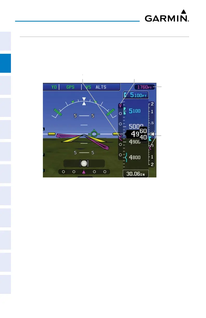
USING THE VNAV FEATURE
Use the VNAV (Vertical Navigation) feature to ensure the aircraft is at the proper
altitude. The magenta VNAV Indicator appears on the PFD. A message appears when
approaching the VNAV Profile. When the VNAV Indicator is in the vertical center of
the Vertical Deviation Scale, the aircraft is at the proper altitude for the VNAV Profile.
VNAV Indications
Vertical Deviation ScaleVNAV Indicator
Required Vertical
Speed Indicator
VNAV Target
Altitude
Configuring a VNAV profile:
1)
Press the MENU Key twice.
2)
Touch VNAV.
3)
Touch the Waypoint field and choose the desired VNAV waypoint.
4)
Touch the Profile value.
5)
Enter the desired descent rate in fpm using the keypad and touch Enter.
6)
Touch the Altitude value.
7)
Enter the desired altitude using the keypad and touch Enter.
8)
Touch Above WPT or MSL.
9)
Touch the By value.
10)
Enter the desired distance using the keypad and touch Enter.
11)
Touch Before or After.

 Loading...


