Garmin G3X Touch
™
Pilot’s Guide for Certified Aircraft
190-02472-00 Rev. D 147
GPS Navigation
System
Overview
Flight
Instruments EIS
CNS
Interface
GPS
Navigation
Flight
Planning
Hazard
Avoidance
Additional
Features AFCS Annun/Alerts Appendix Index
MEASURING BEARING AND DISTANCE
The ‘Measure Distance’ option on Map Page menu is useful for measuring the distance
between two points on the map. The distance tool displays a dashed Measurement
Line and a Map Pointer to aid in graphically identifying points to measure. Lat/Long,
bearing, distance, and elevation data is provided.
Measuring bearing and distance between any two points:
1)
From the Map Page, press the MENU Key.
2)
Touch Measure Distance.
3)
Touch any point on the viewable navigation map to select the first reference
point.
4)
Touch Set Ref to select the second reference point to receive distance and
bearing information from the first reference point to the second reference
point.
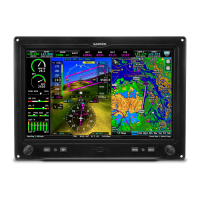
Map Page (Measure Distance)
Measurement
Line
Reference
Point
TOPOGRAPHY
Topographic data can be displayed or removed as described in the following
procedures.
Displaying/removing topographic data:
1)
From the Map Page, press the MENU Key.
2)
Touch Topo Shading.
 Loading...
