Garmin G3X Touch
™
Pilot’s Guide for Certified Aircraft
190-02472-00 Rev. D
146
GPS Navigation
System
Overview
Flight
InstrumentsEIS
CNS
Interface
GPS
Navigation
Flight
Planning
Hazard
Avoidance
Additional
FeaturesAFCSAnnun/AlertsAppendixIndex
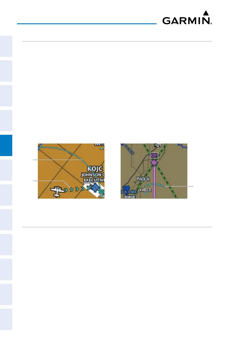
BEST AIRPORT LINE
The Best Airport Line points to the same airport as the Best Airport Bearing Pointer
but is available on the MFD and Split Screen Map displays instead of the HSI. The line
appears as a series of cyan chevrons between the aircraft marker and the recommended
glide-to airport.
Displaying/removing the Best Airport Line:
1)
With the Map Page displayed, press the MENU Key.
2)
Touch Set Up Map.
3)
Touch and drag the tabs left or right to find the desired tab.
4)
Touch the ‘Line’ Tab.
5)
In the Best Airport Line field, touch On or Off.
Navigation Map
Selected
Altitude
Intercept
Arc
Navigation Map
Best
Airport
Line
Glide
Range
Ring
SELECTED ALTITUDE INTERCEPT ARC
The map can display the location along the current track where the aircraft will
intercept the selected altitude. The location will be shown as a cyan arc when the
aircraft is climbing or descending.
Displaying/removing the selected altitude intercept arc:
1)
With the Map Page displayed, press the MENU Key.
2)
Touch Set Up Map.
3)
Touch and drag the tabs left or right to find the desired tab.
4)
Touch the ‘Map’ Tab.
5)
In the Selected Altitude Intercept Arc field, touch On or Off.

 Loading...


