Garmin G3X Touch
™
Pilot’s Guide for Certified Aircraft
190-02472-00 Rev. D 219
Hazard Avoidance
System
Overview
Flight
Instruments EIS
CNS
Interface
GPS
Navigation
Flight
Planning
Hazard
Avoidance
Additional
Features AFCS Annun/Alerts Appendix Index
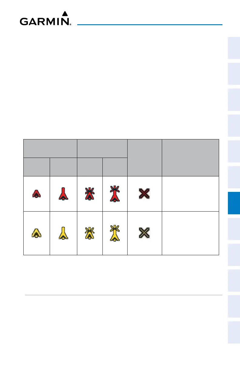
OBSTACLE INFORMATION
Obstacles are shown on the Terrain Page at or below the map range of 12 nm.
Obstacles are also shown on the Map Page when the map range is set to 3 nm or
below.
Standard aeronautical chart symbols are used for lighted or unlighted obstacles
taller than 200 feet Above Ground Level (AGL). Refer to the Obstacle Icons legend
below.
Each obstacle is labeled with the altitude of the top of the obstacle, or Mean Sea
Level (MSL). Each obstacle also lists, in parentheses, the actual height of the obstacle,
or Above Ground Level (AGL).
Unlighted
Obstacle
Lighted Obstacle
Potential
Impact
Points
Obstacle Location
< 1000’
AGL
> 1000’
AGL
< 1000’
AGL
> 1000’
AGL
WARNING: Red
obstacle is above or
within 100’ below
current aircraft altitude
CAUTION: Yellow
obstacle is between
100’ and 1000’
(default) below current
aircraft altitude
Terrain Obstacle Colors and Symbology
TERRAIN SETTINGS
Use the terrain settings to set levels for terrain alerts as well as obstacles in or
near your flight path.
• Caution Elevation—The G3X Touch will provide an alert if the terrain or obstacle
is within the default Caution Elevation or user-defined Caution Elevation.

 Loading...


