Garmin G3X Touch
™
Pilot’s Guide for Certified Aircraft
190-02472-00 Rev. D
164
GPS Navigation
System
Overview
Flight
InstrumentsEIS
CNS
Interface
GPS
Navigation
Flight
Planning
Hazard
Avoidance
Additional
FeaturesAFCSAnnun/AlertsAppendixIndex
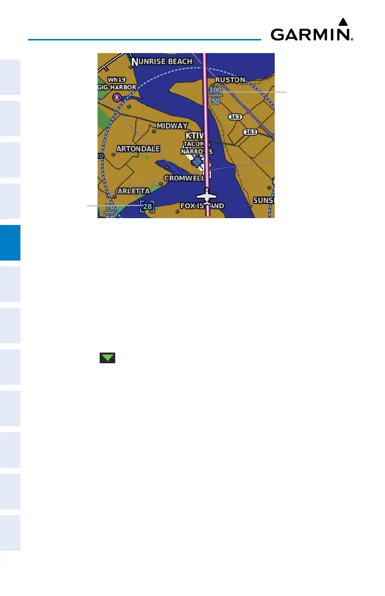
Smart Airspace
™
with Altitude Overlays
De-emphasized
Altitude Overlay
Altitude
Overlay
Enabling/disabling Altitude Overlays:
1)
Press the MENU Key twice.
2)
Touch Setup.
3)
Touch Map.
4)
Touch and drag the tabs left or right to find the desired tab.
5)
Touch the ‘Airspace’ Tab.
6)
Touch and drag to display the 'Altitude Labels' field.
7)
Touch the to display a list of options.
8)
Touch Off, Auto, 2nm, 3nm, 5nm, 8nm, 12nm, 20nm, 30nm, 50nm,
80nm, or 120nm.
5.6 DIRECT-TO NAVIGATION USING THE G3X TOUCH
The Direct-to method of navigation, initiated by pressing the Direct-to Key is
quicker to use than a flight plan when the desire is to navigate to a single point such
as a nearby airport.

 Loading...


