Garmin G3X Touch
™
Pilot’s Guide for Certified Aircraft
190-02472-00 Rev. D 217
Hazard Avoidance
System
Overview
Flight
Instruments EIS
CNS
Interface
GPS
Navigation
Flight
Planning
Hazard
Avoidance
Additional
Features AFCS Annun/Alerts Appendix Index
Alert windows appear on all pages (except the Terrain (Ter) Page) to inform the pilot
of proximity to the terrain and obstacles, as well as an unsafe descent rate. These
alerts depend on user-defined parameters in the Terrain Page setup.
SYNTHETIC VISION
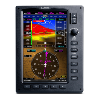
Terrain is integrated within Synthetic Vision (when active) to provide land contours
(colors are consistent with those of the topographical map display), large water
features, towers, obstacles over 200’ AGL, as well as visual and auditory alerts to
indicate the presence of terrain and obstacle threats relevant to the projected flight
path. Synthetic Vision terrain information is displayed in red and yellow shading on the
PFD. Refer to Section 8.1 (Synthetic Vision) for more information.
TERRAIN INFORMATION
The areas of the terrain shaded red are predicted to be within 100 feet below or
above the aircraft. The yellow terrain areas are between the user-defined Caution
Elevation and 100 feet below the aircraft. By default, the Caution Elevation is 1,000
feet; therefore, the areas in yellow are between 1,000 feet and 100 feet below the
aircraft. The black areas are further than the Caution Elevation. A projected point of
impact is marked with an “X” symbol.
Enabling/disabling Terrain Shading on the Map Page:
From the Map Page, press MENU, then touch Terrain.
 Loading...
