Garmin G1000 Pilot’s Guide for the Diamond DA42NG
190-00-00962-02 Rev. A
304
HAZARD AVOIDANCE
SYSTEM
OVERVIEW
FLIGHT
INSTRUMENTS
EIS
AUDIO PANEL
& CNS
FLIGHT
MANAGEMENT
HAZARD
AVOIDANCE
AFCS
ADDITIONAL
FEATURES
APPENDICESINDEX
ICING (CIP & SLD)
NOTE: Icing data cannot be displayed at the same time as NEXRAD data.
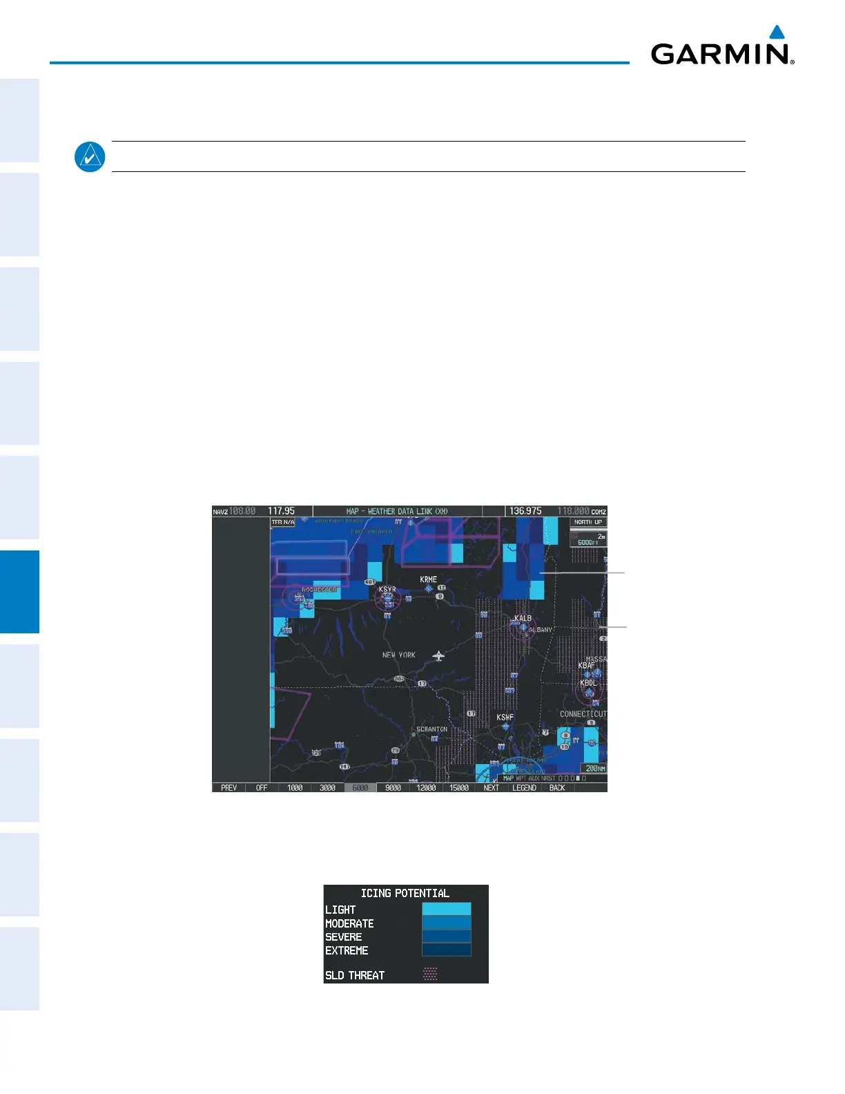
CurrentIcingProduct(CIP)datashowsagraphicalviewofthecurrenticingenvironment(Figure6-42).
Icingseverityisdisplayedin fourcategories:light,moderate,severe,andextreme(notspecictoaircraft
type). The CIP productisnotaforecast, butapresentation ofthecurrentconditionsatthetime of the
analysis.
SupercooledLarge Droplet(SLD) icing conditions arecharacterized by the presence of relativelylarge,
supercooledwaterdropletsindicativeoffreezingdrizzleandfreezingrainaloft.SLDthreatareasaredepicted
asmagentadotsovertheCIPcolors.
Displaying Icing data:
1) Select the Weather Data Link (XM) Page.
2) Press the
MORE WX
Softkey.
3) Press the
ICNG
Softkey.
4) Select the desired altitude level: 1,000 feet up to 30,000 feet. Press the
NEXT
or
PREV
Softkey to cycle through
the altitude softkeys. The
ICNG
Softkey label changes to reflect the altitude selected.
Figure 6-42 Icing Data at 9,000 Feet
SLD Threat
Icing
Potential
TodisplaytheIcingPotentiallegend(Figure6-43),pressthe
LEGEND
SoftkeywhenIcingdataisdisplayed.
Figure 6-43 Icing Potential Legend

 Loading...


