Garmin G1000 Pilot’s Guide for the Diamond DA42NG
190-00962-02 Rev. A492
ADDITIONAL FEATURES
SYSTEM
OVERVIEW
FLIGHT
INSTRUMENTS
EIS
AUDIO PANEL
& CNS
FLIGHT
MANAGEMENT
HAZARD
AVOIDANCE
AFCS
ADDITIONAL
FEATURES
APPENDICESINDEX
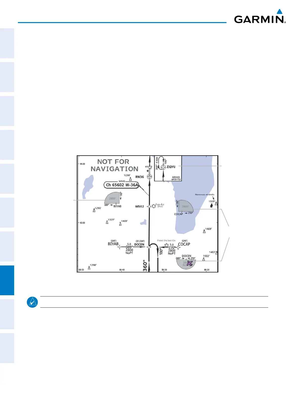
8.3 CHARTVIEW (OPTIONAL)
ChartViewresemblesthepaperversionofJeppesenterminalprocedurescharts.Thechartsaredisplayedinfull
colorwithhigh-resolution.TheMFDdepictionshowstheaircraftpositiononthemovingmapintheplanview
ofapproachchartsandonairportdiagrams.AirportHotSpotsareoutlinedinmagenta.
The geo-referenced aircraft position is indicated by an aircraft symbol displayed on the chart when the current
positioniswithintheboundariesofthechart.Insetboxes(Figure8-20)arenotconsideredwithinthechart
boundaries. Therefore, when the aircraft symbol reaches a chart boundary line, or inset box, the aircraft symbol
is removed from the display.
Figure8-20showsexamplesofoff-scaleareas,indicatedbythegreyshading.Note,thegreyshadingisfor
illustrative purposes only and will not appear on the published chart or MFD display. These off-scale areas
appearonthecharttoconveysupplementalinformation.However,thedepictedgeographicalpositionofthis
information, as it relates to the chart planview, is not the actual geographic position. Therefore, when the aircraft
symbol appears within one of these areas, the aircraft position indicated is relative to the chart planview, not to
the off-scale area.
Figure 8-20 Sample Chart Indicating Off-Scale Areas
Off-Scale
Area
Off-Scale
Areas
Inset Box
NOTE: Do not maneuver the aircraft based solely upon the geo-referenced aircraft symbol.
TheChartViewdatabasesubscriptionisavailablefromJeppesen,Inc.Availabledataincludes:
•Arrivals(STAR)
•DepartureProcedures(DP)
•Approaches
•AirportDiagrams
•NOTAMs

 Loading...


