Garmin G1000 Pilot’s Guide for the Diamond DA42NG
190-00-00962-02 Rev. A
320
HAZARD AVOIDANCE
SYSTEM
OVERVIEW
FLIGHT
INSTRUMENTS
EIS
AUDIO PANEL
& CNS
FLIGHT
MANAGEMENT
HAZARD
AVOIDANCE
AFCS
ADDITIONAL
FEATURES
APPENDICESINDEX
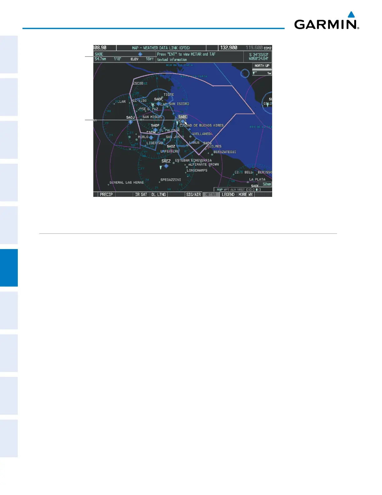
Figure 6-63 Map Panning on the Weather Data Link (GFDS) Page
Instructions
for Viewing
METAR and
TAF Text
METAR
Selected
with Map
Pointer
GFDS WEATHER DATA REQUESTS
TheGFDSDataRequestwindowprovidestheightcrewwiththeoptionstoenableordisabletherequested
weathercoveragearea(s),chooseautomaticweatherupdateintervals(ifdesired),andtheabilitytosendorcancel
weatherdatarequests.ThestatusoftheGFDSdatarequestprocessisalsodisplayed.
BeforeaGFDSdatarequestcanoccur,avalidrequestcoverageareamustbedenedfromwhichallcurrently
availableGFDSweatherproductswill be retrieved.Ataminimum,eithertheaircraft’s present position or a
waypoint(aspartofaightplanorentereddirectlyinthe‘WAYPOINT’coverageeld)mustbepartoftherequest
coveragearea,otherwisetherequeststatuswindowwillindicate‘INVALIDCOVERAGEAREA’andthesystemwill
notallowarequesttooccur.
Itisnotnecessaryforadestination(basedonanactiveightplan),aightplan,orwaypointtobespecied
priortoenablingthesecoverageareas;howevernoweatherdatawillberetrievedfortheseoption(s)untilaight
plan or waypoint is provided, respectively.
Requesting GFDS weather data manually:
1) Select the Weather Data Link (GFDS) Page.
2) Press the MENU Key.
3) With ‘GFDS Data Request’ highlighted, press the
ENT
Key (Figure 6-64).
4) Turn the large FMS Knob to highlight the desired coverage option(s) and press the
ENT
Key to check or uncheck
one of more of the following coverage selections (Figures 6-65, 6-66):
•PRESENT POSITION – Requests data based on current location.

 Loading...


