190-00962-02 Rev. A
Garmin G1000 Pilot’s Guide for the Diamond DA42NG
397
HAZARD AVOIDANCE
SYSTEM
OVERVIEW
FLIGHT
INSTRUMENTS
EIS
AUDIO PANEL
& CNS
FLIGHT
MANAGEMENT
HAZARD
AVOIDANCE
AFCS
ADDITIONAL
FEATURES
APPENDICES INDEX
6) Turn the small
FMS
Knob to scroll through options for each product (ON/OFF, range settings).
7) Press the
ENT
Key to select an option.
8) Press the FMS Knob or CLR Key to return to the Navigation Map Page with the changed settings.
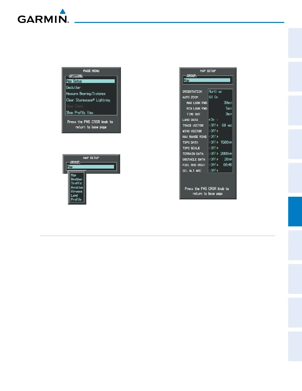
Figure 6-150 Navigation Map Page Setup Menu
Figure 6-149 Navigation Map Page Menu
Figure 6-151 Navigation Map Page Setup Menu, Map Group
TERRAIN-SVS PAGE
TheTerrain-SVSPageisspecializedtoshowterrain,obstacle,andpotentialimpactpointdatainrelationto
theaircraft’scurrentaltitude,withoutclutterfromthebasemap.ItistheprincipalmappageforviewingTerrain-
SVSdata.Aviationdata(airports,VORs,andotherNAVAIDs)canbedisplayedforreference.Ifanobstacleand
theprojectedightpathoftheaircraftintersect,thedisplayautomaticallyzoomsintotheclosestpotentialpoint
ofimpactontheTerrain-SVSPage.
Aircraftorientationonthismapisalwaysheadingupunlessthereisnovalidheading.Twoviewsareavailable
relativetothepositionoftheaircraft:the360°defaultdisplayandtheradar-likeARC(120°)display.Maprange
isadjustablewiththeRANGE Knobfrom1to200nm,asindicatedbythemaprangerings(orarcs).
Displaying the Terrain-SVS Page:
1) Turn the large
FMS
Knob to select the Map Page Group.
2) Turn the small
FMS
Knob
to select the Terrain-SVS Page.
Changing the Terrain-SVS Page view:
1) Press the
VIEW
Softkey.
2) Press the 360 or ARC Softkey to select the desired view.

 Loading...


