8.
1Chartappoverview
TheChartappdisplaysarepresentationofyourvesselinrelationtolandmassesandothercharted
objects,whichenablesyoutoplanandnavigatetoyourdesireddestination.TheChartapprequires
aGNSS(GPS)positionfixinordertodisplayyourvesselatthecorrectlocationonaworldmap.
ForeachinstanceoftheChartappyoucanselectwhichelectroniccartographyyouwanttouse.
Theselectionwillpersistoverapowercycle.
TheChartappcanbedisplayedinbothfullscreenandsplitscreenapppages.Apppagesmay
consistofupto4instancesoftheChartapp.
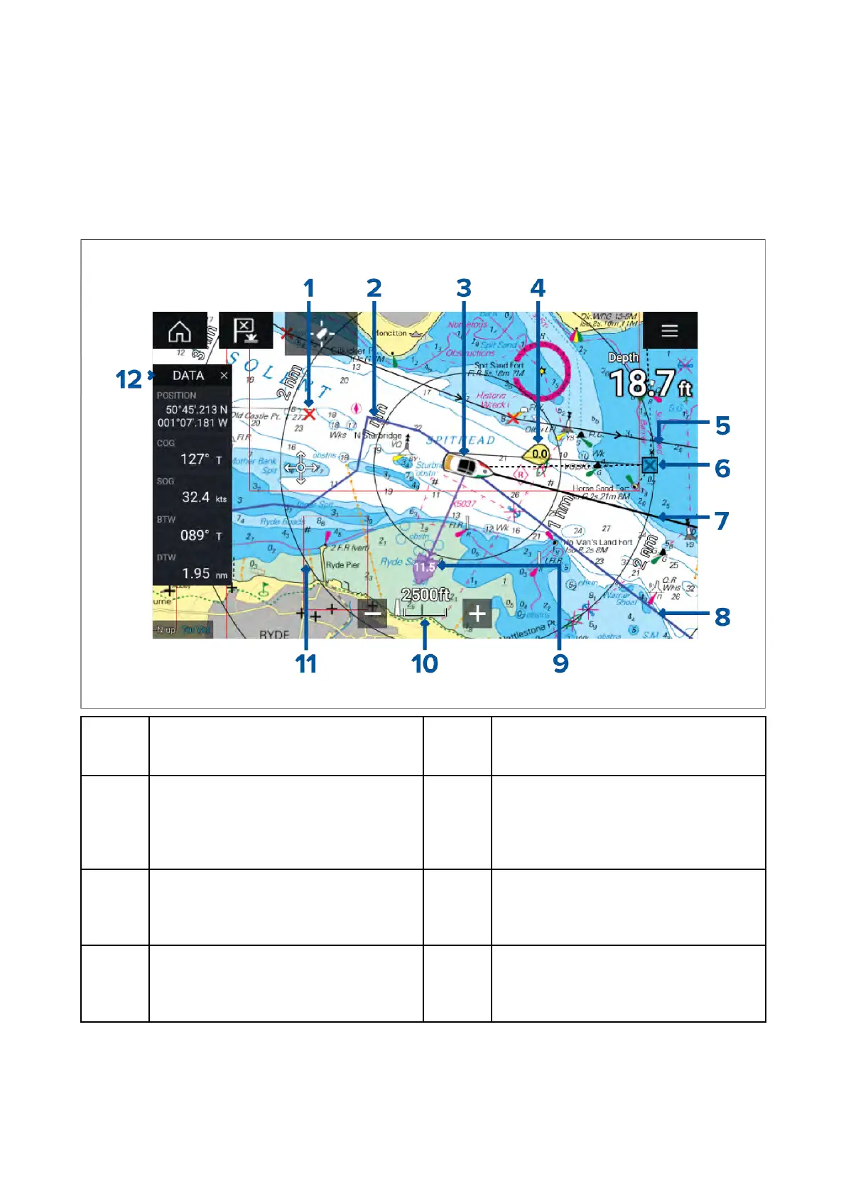
1
W aypoint
Usewaypointstomarkspecific
locationsorpointsofinterest.
2
Track
Y oucanrecordthepassageyour
vesseltakesusingTracks.
3
V esselicon
Thisiconrepresentsyourvessel,only
displayedwhenaGNSS(GPS)position
fixisavailable.Theiconwillbeablack
dotifnoHeadingisavailable).
4
Windindicator
Providesindicationofwinddirection
andspeed(Windtransducerrequired).
5R oute
Y oucanplanyourrouteinadvance
bycreatingaRouteusingWaypoints
tomarkeachrouteleg.
6
Destinationwaypoint
DuringaGoto,thisisthecurrent
destinationwaypoint.
7
Headingline
IfHeadingdataisavailable ,a
Headingvectorforyourvesselcanbe
displayed.
8
COGline
IfCOGdataisavailable,youcan
displayaCOGvectorforyourvessel.
122

 Loading...