LightHousechartsdynamictidegraphic
WhentheTideslayerisenabledorwhentheChartappisin
Tidesmode,thestandardTidestation
symbolisreplacedwithadynamicTideheightgraphic:
1.Hightide(FullGreenindicatorwithequalssymbol)
2.Decreasingtide(R eddecreasingindicatorwithdownarrow)
3.Lowtide(NearlyemptyGreenindicatorwithequalssymbol)
4.Increasingtide(Greenindicatorwithuparrow)
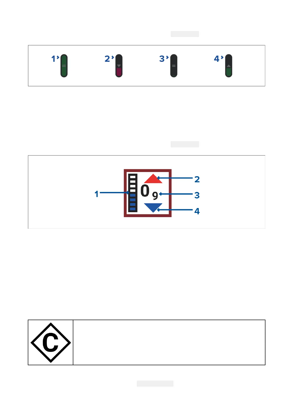
Navionicsdynamictidegraphic
WhentheTideslayerisenabledorwhentheChartappisin
Tidesmode,thestandardTidestation
symbolisreplacedwithadynamicTideheightgraphic:
1.Tidebar—Thetidebarplotsthecurrenttideheightagainstthemaximumpredictedtide
heightforthatday .
2.Redarrowindicatestideheightisincreasing.
3.Tideheight—Tideheightisdisplayedinuser-selecteddepthunits,withdecimalsdisplayedin
subscript.Decimalsarenotshownforvaluesof10orgreater.
4.Bluearrowindicatestideheightisdecreasing.
Currentstationinformation
Dependingonyourcartography,Currentstationinformationmaybeavailableatthelocationof
Currentstations.
Currentstationsymbol
ThelocationofCurrentstationsismarkedontheChartusingadiamond-shaped
symbolwitha‘C’inthemiddle.Thesymbolcolormayvary.
Currentgraph
Currentgraphscanbeaccessedbyselecting CurrentstationfromtheCurrentstation’scontext
menu.
Chartapp
167

 Loading...