SettingDescriptionOptions
Adjustfortides
•Adjustthelaylinestotak
e
intoaccounttidalflow.
•On
•Off
Boattype
•Setyourvessel’
sboattype
toprovidemoreaccurate
leewaycalculation.
•ListofavailableBoattypes
Showwindshifts
•Displaytheminimumand
maximumwaypointlaylines,
basedonthevaryingT
rue
WindDirection(TWD)over
thelastspecifiedperiod.
•On
•Off
(Windshifts)TimeP eriod
•Setthespecifiedtimeperiod
forwindshifts.
•3min
•6min(default)
•12min
•30min
•60min
(Windshifts)R eset
•Resettherecordedtimeof
historicalwindshiftsbackto
0.
•Reset
Displayingandinterpretinglaylines
Oncelaylinesareenabledandcorrectlyconfiguredinthe
LaylinestabintheChartappSettings,they
willstartrenderingontheChartdisplayasyourvesselisunderway.
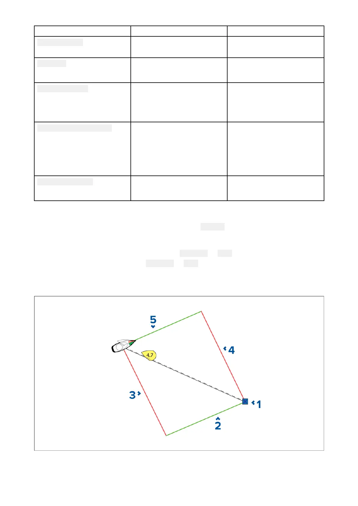
Laylinesaredisplayedasaparallelogramunderthefollowingconditions:
•Thevesselisunderactivenavigationtowardsa
Waypointor Goto.
•AtackisrequiredtomeetanactiveWaypointor Goto.
•Thedirectdistancetothedestinationpointislessthan150nmfromyourvessel.
Whenthedestinationpointisupwindthelaylineswillbedisplayedinaparallelogramformation,with
greenandredlaylinesshowingtheportandstarboardtack
s,asshownbelow:
1.Destination
2.S tarboarddestinationlayline
3.Portvessellayline
Chartapp
187

 Loading...