EasyManuals Logo

Komatsu PC390LCi-11 User Manual

Komatsu PC390LCi-11
376 pages
To Next Page IconTo Next Page
To Previous Page IconTo Previous Page
Page #136 background imageLoading...
Page #136 background image
SELECT WORLD GEODETIC SYSTEM (WGS) COORDINATES
Y
ou can select “World Geodetic System”.
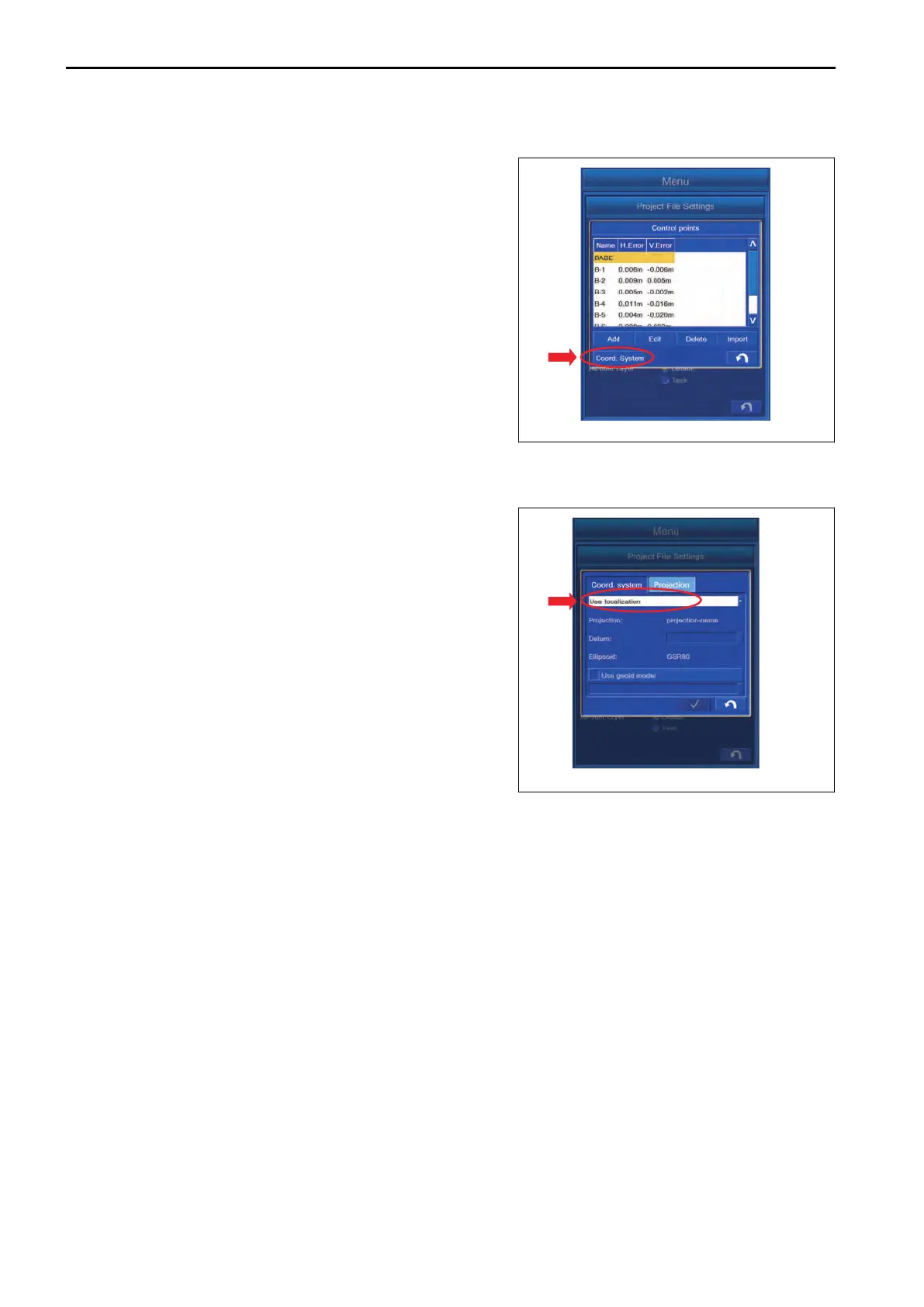
Tap “Coord. System” button on “Control points” setting screen.
METHOD FOR USING LOCALIZATION
You can select “World Geodetic System”.
Select “Coord. system” tab, and select “Use localization”.
The Control Point which is measured based on USA WGS84
“World Geodetic System 1984” is used.
METHOD FOR USING PREDEFINED PROJECTION
Select “Projection” tab, and highlight “World Geodetic System” to be used.
CONTROL BOX SETTING
7-20

Table of Contents

Questions and Answers:

Question and Answer IconNeed help?

Do you have a question about the Komatsu PC390LCi-11 and is the answer not in the manual?

Komatsu PC390LCi-11 Specifications

General IconGeneral
BrandKomatsu
ModelPC390LCi-11
CategoryExcavators
LanguageEnglish

Related product manuals