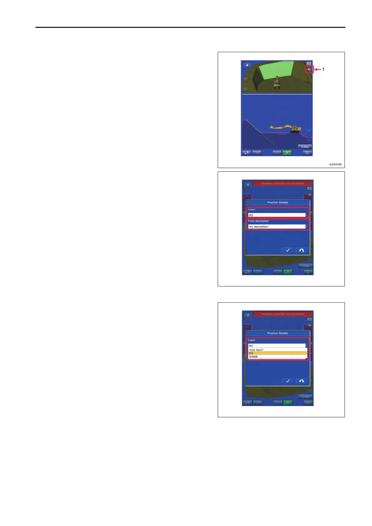
3.
Move
the bucket edge to the desired point and tap the but-
ton (1).
4.
The screen for inputting the name of Layer to be saved
and Point description (bucket edge position data) is dis-
played.
The name of set Layer and Point description (bucket edge
position data) are displayed if they have been already set.
METHOD FOR CREATING NEW LAYER TO RECORD DATA
Select the “<new layer>” on the layer column, and input a
name.
If the layer for saving data is in a list, select the layer.
EXECUTIONS USE OF TOPO SURVEY
8-53
 Loading...