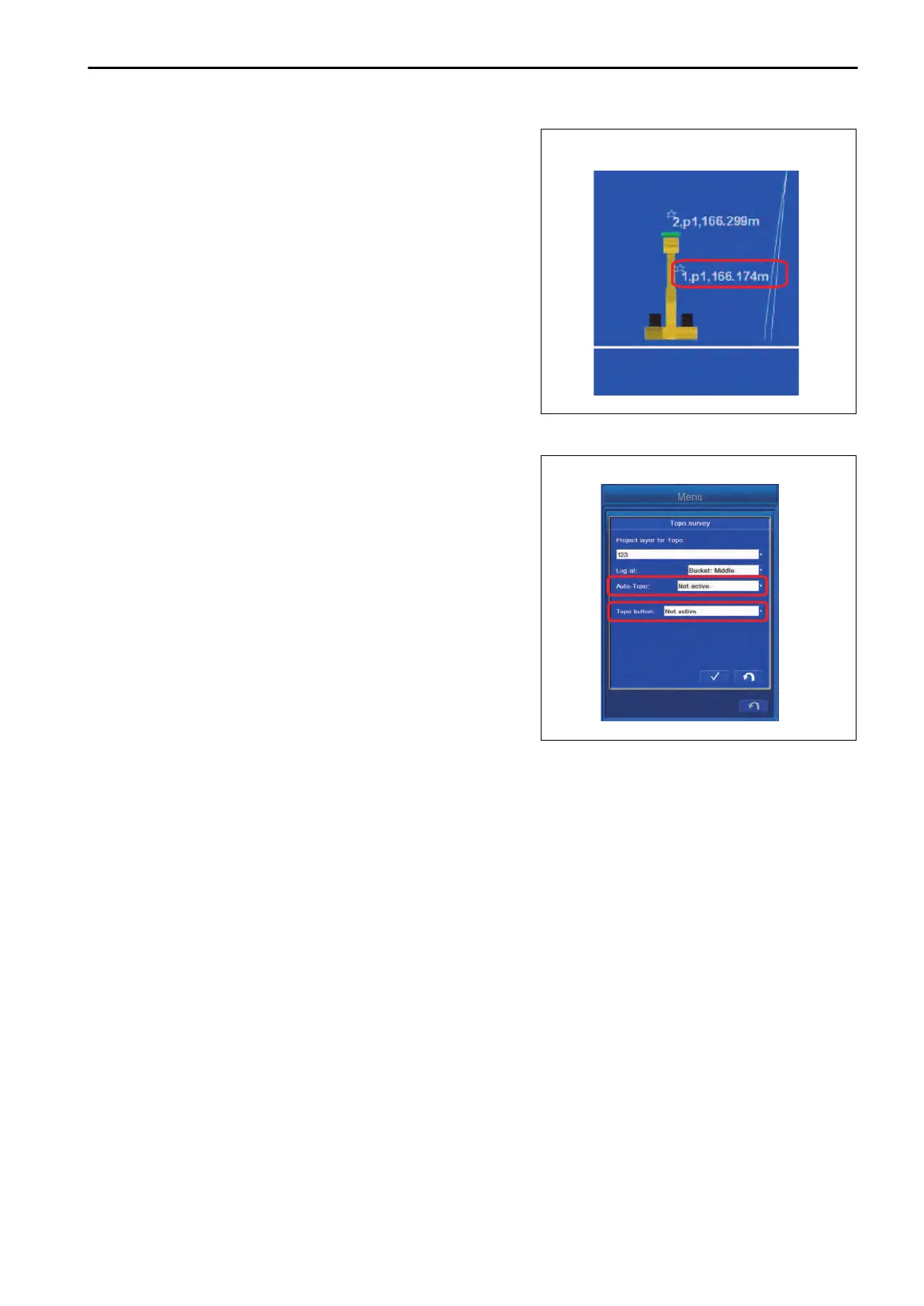
4.
The
details of the topographic survey point are displayed
and recorded.
Contents of display are “Symbol”, “Number”, “Name”, and
“Elevation”.
For the setting procedure of display, see “METHOD FOR
SETTING LAYERS”.
METHOD FOR CANCELING TOPOGRAPHIC SURVEYS
Set the “Auto-Topo” to “Not active”, and set the “Topo button” to
“Not active” as well.
EXECUTIONS USE OF TOPO SURVEY
8-55
 Loading...