Home
Komatsu
Excavators
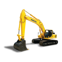
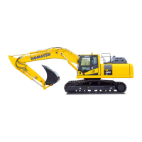
PC390LCi-11
Komatsu PC390LCi-11 User Manual
5
of 1
of 1 rating
376 pages
Give review
Manual
Specs
To Next Page
To Next Page
To Previous Page
To Previous Page
Loading...
T
o set it to display
, put a tick in the check box.
METHOD FOR SETTING ST
A
TION LABELS DISPLA
Y
Y
ou can set Display/Non-display of “Station labels”.
T
o set it to display
, put a tick in the check box.
METHOD FOR SETTING ST
A
TION INTERV
AL
Y
ou can set Station interval of “Alignment”.
SETTING
CONTROL BOX
7-97
212
214
Table of Contents
Safety Information
5
Introduction
6
Main Use of Machine
6
Intelligent Machine Control
6
Table of Contents
7
Safety
9
Safety Labels
11
Location of Safety Labels
12
Caution for Handling Control Box
13
Safety Labels
13
Precautions for Operation
16
Start Engine
16
Checks and Adjustment before Starting Engine
16
Precautions Related to Control Box
16
Precautions Related to Semi-Auto Mode
17
Precautions for Transportation
17
Precautions When Loading and Unloading
17
Operation
19
General View
20
Machine Equipment Name
20
Details of a and B Part
21
Details of C to F Part
22
Cab Equipment Names
23
Explanation of Components
24
Explanation of Machine Monitor Equipment
24
Displaying Only Meters
25
Standard Screen (Camera Display and Meter Display)
26
Whole Camera Image Display Screen
26
Standard Screen (Only Meters Are Displayed)
27
Action Level Display
28
List of Action Level Display and Remedies
28
Caution Lamp List
28
Caution Lamps and Display Colors
29
Current Abnormality Display Switch
29
Operation on the Current Abnormality Screen
30
Intelligent Machine Control EQUIPMENT STATE CAUTION LAMP
30
When Action Level “L04” Is Displayed
30
When Action Level “L03” Is Displayed
30
Intelligent Machine Control SYSTEM STATE CAUTION LAMP
31
Action Level “L04”
31
Action Level “L03”
31
Calibration State Caution Lamp
31
Cylinder Function State Caution Lamp
32
Switch
33
Lamp Switch
34
Boom Secondary Drive Switch
34
Night Position
34
Day Position
34
Auto/Manual Switch
35
Semi-Auto Mode
35
Control Levers and Pedals
36
Lock Lever
36
Manual Mode
36
Automatic Lock Function of Lock Lever
37
Intelligent Machine Control SYSTEM
38
Power Supply State LED
39
USB Port
41
Network Modem
41
How These Various State LED Work
42
Display of the Power Supply State LED
42
Other Equipment
43
Method for Opening and Closing Cab Front Window
43
Method for Opening Cab Front Window
43
Method for Closing Cab Front Window
47
Cup Holder
51
Power Supply Outlet
51
24V Power Supply
51
12V Power Supply
51
Fuse Capacities and Circuit Names
52
Operation of Battery Disconnect Switch
53
Method for Removing and Installing Control Box
54
Method for Removing Control Box
54
Method for Installing Control Box
56
Machine Operations and Controls
58
Checks and Adjustment before Starting Engine
58
Method for Walk-Around Check
58
Method for Adjusting
60
Method for Adjusting Operator's Seat
60
Method for Adjusting Seat in Fore-And-Aft Direction
60
Method for Reclining Seat
60
Method for Adjusting Armrest Height
61
Method for Adjusting Headrest in Vertical Direction
61
Method for Adjusting Seat Height
61
Air Suspension Seat
62
Method for Adjusting Air Suspention Seat Hardness
62
Method for Adjusting Armrest Angle
62
Method for Adjusting Seat Unit in Fore-And-Aft Direction
62
Method for Installing Headrest
63
Method for Removing and Installing Headrest
63
Method for Removing Headrest
63
Method for Adjusting Control Box Position
64
Method for Starting Engine
65
Method for Starting Control Box
68
Control Box Starts Automatically
69
Method for Resetting Stroke of the Work Equipment Cylinder
70
Method for Shutting down Control Box
70
Method for Stopping Engine
72
Prohibited Operations
74
Prohibition of Operations Using Hydraulic Cylinders to Stroke End
74
Method for Parking Machine
75
Handling Radio
77
Transportation
78
Remove and Install Gnss Antenna
78
Method for Removing Gnss Antenna
78
Remove and Install Handrail
80
Removal and Installation Order of Handrail
81
Method for Removing Handrail
81
Method for Installing Handrail
82
Remove and Install Gnss Antenna and Antenna for Network Modem
82
Remove the GNSS Antenna
84
Remove the Antenna for Network Modem
85
Method for Installing Gnss Antenna and Antenna for Network Modem
86
Precautions for Long-Term Storage
89
Starting Machine after Long-Term Storage
89
Troubles and Actions
90
If Error Information Is Displayed on Control Box
90
IF Initializing IS DISPLAYED
90
When "Initializing..." Is Displayed While the Machine Travels
91
Semi-Auto Mode Waiting State
91
Semi-Auto Mode Operating State
91
Other Trouble
92
If Machine Monitor Shows Warning Display
92
Phenomena and Actions for Control Box
92
Error by Failure in the Electrical Component
92
ACTION for Komatsu Controller Not Connected
93
ACTION for GPS Receiver Not Connected
93
ACTION for Site Link Server Not Connected
93
ACTION for Tilt Bucket Sensor Offline
94
ACTION for Sensors Are Invalid
94
Other Error
94
ACTION for no GPS Localization
95
ACTION for Waiting for Satellites
96
ACTION for Waiting for Radio Link
96
ACTION for Waiting to Initialize
97
When the Connector Is Connected Correctly
98
ACTION for Initializing
98
ACTION for Low Precisions
100
ACTION for out of Design Area
100
ACTION for Avoidance Area Breach
100
ACTION for Komatsu Controller Is Busy Calibration Rejected
101
DISPLAY of MESSAGES of Sitelink3D
101
ACTION for Please Select an Operator
101
ACTION for Registered Terminal Name:contents of Message
102
Maintenance
103
Maintenance Schedule Table
104
Maintenance Procedure
105
Every 500 Hours Maintenance
105
Method of Checking and Cleaning Cylinder Stroke Sensor Case Bolt
105
Specifications
107
Specifications: Pc360Lci-11, Pc390Lci-11
108
Attachments and Options
111
Method for Changing Control Patterns
112
Control Patterns Other than Standard Control Method
113
ISO Pattern
113
Backhoe Pattern
113
Recommended Attachment Operations
114
Hydraulic Breaker
114
Applicable Work
114
Road Construction
114
Setting
117
Intelligent Machine Control Settings
118
Control Box
118
Machine Monitor
118
Main Menu Display
119
Method for Displaying Main Menu
119
Control Box
119
Exit Button
120
Machine Setup Button
120
RETURN Button
120
Tools Button
120
Method for Importing Project File
121
Method for Setting Project File
121
Project File Setting Contents
121
Create New Project File
122
Method for Creating New Project File
122
Method for Copying Project File
125
Method for Deleting Project File
127
When Copying Project File Saved in the Control Box to USB Flash Drive
127
Method for Exporting Project File
128
Control Point Settings
129
Control Point Setting Contents
130
Setting Contents by Adding Control Points
130
Method for Editing Control Points
131
Method for Deleting Control Points
132
Import Control Points
133
Method for Using Localization
136
Select World Geodetic System (Wgs) Coordinates
136
Method for Copying Geoid Files
137
Method for Copying Geoid Files to Usb Memory
139
Method for Creating New Point
140
Point Setting and Editing
140
Point Setting Contents
140
Method for Editing Existing Point
141
Method for Deleting Existing Point
142
Method for Importing Surfaces from Project File
142
Surfaces Settings
142
Method for Creating New Surfaces
144
Method for Editing Surfaces
144
Coordinates of the Specified Point
145
Flat Plane Surface
145
Grid Interval
146
When Using Bucket Edge Coordinates
146
When Using the Existing Point Coordinates
146
Method for Creating Sloping Plane Surface
148
Sloping Plane Surface
148
Sloping Plane Surface Setting Contents
148
Crown Road Surface
152
Crown Road Surface Setting Contents
153
Input of Machine Grade in Longitudinal Direction
153
Method for Creating Crown Road Surface
153
Setting of “Starting Point”
153
Method for Creating Surface by Offsetting Existing Alignment
155
Method for Creating Surface by Offsetting Existing Surface
155
Creation of Surface of the Road
156
Method for Setting Display/Non-Display of Surface
156
Method for Deleting Surfaces
157
Method for Importing Surfaces
158
Method for Importing Surfaces from Usb Flash Drive
158
Contents of Operation by Layer Setting
161
Layers Settings
161
Method for Creating New Layers
161
Method for Changing Point Color Selection
162
Method for Setting Layers Display
162
Method for Changing Point Symbol
163
Method for Deleting Layers
163
Import 3D Points File and 3D Linework File
164
Method for Copying Points File and Linework File from 3Dmc Folder
165
Avoidance Data Settings
166
Method for Setting Avoidance Data Proximity
166
Method for Setting Avoidance Data Shape
166
Surface Mode Settings
167
As-Built View Settings
168
Cut Fill Settings
168
Select As-Built View
168
Guidance Settings
169
Pass Count Settings
169
Guidance Setting Contents
170
Measurement Distance Line
170
Steer Indication
170
“Light Bar” Button
170
Light Bar and Sound Settings
171
Rough Digging Mode Settings
171
Light Bar and Sound Setting Contents
172
Method for Setting Tolerance in Rough Digging Mode
172
Method for Setting Sound Tone
173
Method for Setting Sound Volume
173
Fine Digging Mode Settings
174
Grade Indicators Settings
174
Method for Inverting Grade Indicator Colors
175
Method for Setting Grade Indicator Extents
176
Method for Setting Green Grade Indicator Width
176
Measurement Distance
177
Method for Setting Left Grade Indicator
177
Method for Setting Right Grade Indicator
177
Steering References Settings
178
Alignment Feature in Steer Indication Settings
179
Method for Setting Navigation of Bucket Edge
179
Steer Reference Setting Contents
179
Additional Steer Offset in Steer Indication Settings
180
Method for Setting Light Bar in Steering References
180
Extents
181
Green
181
Method for Setting Cross Hair in Steering References
181
Yellow
181
As-Built Settings
182
Method for Setting Green Range of Facing Angle Compass
182
Method for Setting Cut Fill Color Selection
183
As-Built Advanced Menu
184
Method for Setting Pass Count Color Selection
184
Method for Setting As-Built Control
185
Display Options
186
Method for Setting Target Surface
186
Bucket Alignment Lines
187
Display Options Contents
187
Screen Layout Settings
187
Working Range
187
Facing Angle Compass
188
Method for Setting Screen Layout for Driving
188
Pop-Up Map
188
Screen Layout
188
Main
189
Sub1
189
View Selections for Driving
190
3D View Point Settings for Driving
191
Method for Setting Screen Layout for Digging
192
View Selections for Digging
194
3D View Point Settings for Digging
195
View Settings
196
3D View Setting Contents
197
3D View Settings
197
Camera Type
197
Focus Point
197
Method for Setting Camera Type
198
Method for Setting Focus Point
199
Method for Setting Background
200
Method for Setting Terrain
201
Plan View Settings
201
Plan View Setting Contents
202
Setting of the Measurement Distance
202
Always Down-Screen
203
Always Up-Screen
203
Method for Setting Direction of Travel
203
Method for Setting Direction of Travel Fixed Degrees
204
Profile View Settings
204
Up-Screen +/- 45
204
Up-Screen +/- 90
204
Method for Displaying Surface Names
206
Section View Settings
206
Elevation Left Edge
207
Section View Settings Contents
207
Setting Items by Center Tab
207
Setting Items by Left Tab
207
Design Data Settings
208
Offset to Line
208
Setting Items by Right Tab
208
Steering Offset
208
Method for Setting Alignment Centerline Color
209
Setting Items by Alignment Tab
209
Method for Setting Alignment Feature Line Color
211
Method for Setting Alignment Station Line Color
212
Method for Setting Regular Station Line Display
212
Method for Setting Station Interval
213
Method for Setting Station Labels Display
213
Method for Setting Cross Selection Color
214
Method for Display Setting by Point Option Tab
215
Point Descriptions
215
Point Elevations
215
Setting Items by Surface Tab
215
Boundaries/Breaklines
216
Contours at Interval
216
Triangle Mesh in Bird Eye View
216
Triangle Mesh in Top Views
216
Language and Units Settings
230
Method for Setting Language
230
Angles
231
Distances
231
Grades
231
Method for Setting Unit
231
Method for Setting Angles
232
Method for Setting Distance
232
Method for Setting Grades
233
Method for Setting Stations
233
Method for Setting Volumes
233
Method for Setting Coordinates
234
Method for Setting Square Measure
234
Site Link Task Detail Menu
234
Task Status Button
234
Check of Task Productivity
235
Check of Task Progress Status
235
Checking Contents by Task Detail Tab
235
“Show Log” Button
235
Setting Contents by Site Link Menu
236
Site Link
236
METHOD for REGISTERING on Sitelink3D
237
Network Connection
237
METHOD for CONNECTING to Sitelink3D
238
Method for Setting Construction Information
240
Method for Outputting Data
241
Method for Sending Message
244
Tools
247
Method for Setting Topo Survey
248
Setting Items by Tools
248
Method for Setting Layers
249
Method for Setting Manual Topo Survey
249
Deactivate Auto-Topo
250
Method for Setting Logging Point
250
Method for Setting Topo Button
250
Method for Setting Auto-Topo (Minimum Horz. Distance)
251
Method for Setting Automatic Topo Survey (Distance Based)
251
Method for Offsetting Lower Elevations
252
Method for Setting Minimum Horiz. Distance
252
Method for Setting Auto-Topo (Fixed Time Interval)
253
Method for Setting Automatic Topo Survey (Time Based)
253
Method for Setting Bucket Edge
253
Method for Displaying Supervisor Menu
256
Method for Setting Supervisor Menu
256
Method for Changing Enable/Disable Setting
259
Method for Resetting Connection
259
About Komatsu HMI (about Product) MENU SETTINGS
260
Authorization Options Display Contents
261
Method for Setting Gnss Radio Device
262
Method for Setting Gnss Radio Configuration
264
Method for Setting Configuration for Topcon Digital 2 (Uhf)
265
Method for Setting Configuration for Topcon Fh915 (Ss)
265
Bucket Configuration
266
Outline of Calibration
266
Precautions for Gnss Radio Configuration
266
Preparations for Calibration
266
Method for Selecting Conventional Bucket Files
269
Method for Measuring Bucket Shape
270
Method for Inputting Bucket Information
274
Method for Measuring Bucket Foot Angle
275
Procedures of Calibration after Replacing Tilt Bucket
278
Method for Selecting Tilt Bucket Files
280
Method for Selecting Tilt Sensor
280
Method for Inputting Bucket Information (Tilt Bucket)
286
Method for Measuring Bucket Foot Angle and Tilt Width Angle
287
Procedures of Calibration of Bucket Tooth
291
Method for Measuring Tooth Length and Inputting Value
293
Imu Adjustment
296
MC Setting
296
Machine Monitor
296
Method for Diagnosing Imu
297
Method for Adjusting Imu
299
Bucket Weight Setting
301
Failure Cause Code List
301
Boom Fine Control Adjustment
302
Method for Adjusting Boom Fine Control
302
Semi-Auto Adjustment
306
Arm Initial Speed
307
Arm Steady Speed
307
Stop Position Adjustment
307
Design Face Date Hold Time in Initialize
307
Method for Adjusting Arm Steady Speed
308
Method for Adjusting Stop Position
308
Method for Adjusting Surface Hold Time at Initialization
308
Executions
311
Semi-Auto Mode
312
Precautions for Operation
312
Precautions for Replacing Parts and Failures
314
Working Mode
314
Semi-Auto Mode Settings
315
Method for Switching to Semi-Auto Mode
316
List of Restricted Items During Semi-Auto Mode
318
Method for Adjusting Control Surface Offset
319
Method for Switching to Manual Mode
320
Travel Mode Settings
321
Display of Travel Mode
321
Offset Menu of Surface
322
Temporary Design Menu
323
Method for Creating Temporary Design Surface
324
Target Surface Settings
324
Rough Digging Mode
325
Method for Setting Rough Digging Screen
325
Bucket Edge Position Selection
327
Bucket Edge Position (Plan View)
327
Fine Digging Mode
329
Method for Setting Fine Digging Mode Screen
329
Target Surface Setting Menu
333
Method for Setting Target Surface
333
Display Bucket Edge Position
336
Display Distance between Bucket Edge and Design Surface
337
Display Bucket Edge Position Algnment Station
337
Display Distance between Center Line and Bucket Edge Position
337
Method for Saving Measured Data
338
Method for Comparing with Benchmark
338
Method for Correcting Bucket Edge Position
339
Daily Calibration
340
Walk-Around Checks of Intelligent Machine Control Equipment
340
Method for Checking Gnss Antenna and Cable
340
Method for Checking Gnss Radio Device
340
Method for Checking Project File
342
Method for Checking Gnss Communication Status
342
Method for Checking Control Box Screen Display
342
Method for Checking and Adjusting Bucket Edge Accuracy
343
Method for Checking Number of Satellites and Error of Positioning
353
Method for Checking Gnss Communication Status
353
Method for Displaying Bucket Edge Coordinates
354
Method for Setting Satellite Position Display and Elevation Angle
354
Method for Displaying Gnss Receiver Information
355
Method for Cheking Expectancy of Edge Accurancy
356
Method for Setting Glonass Satellite
357
Method for Setting Tilt Sensor
357
Use of Topo Survey
359
Method for Performing Topo Survey Manually
359
Create New Layer to Record Data
360
Method for Inputting New Position Details Name
360
Method for Performing Auto-Topo Survey
362
Method for Creating New Layer to Record Data
363
Method for Canceling Topographic Surveys
365
Troubleshooting
366
Control Box Screen Display
366
Semi-Auto Mode
368
Working Accuracy
370
Symbols
371
Index
371
5
Based on 1 rating
Ask a question
Give review
Questions and Answers:
Need help?
Do you have a question about the Komatsu PC390LCi-11 and is the answer not in the manual?
Ask a question
Komatsu PC390LCi-11 Specifications
General
Brand
Komatsu
Model
PC390LCi-11
Category
Excavators
Language
English
Related product manuals
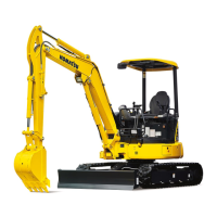
Komatsu PC390LC-10
61 pages
Komatsu PC350-8
381 pages
Komatsu PC300-7
9 pages
Komatsu PC30MR-3
41 pages
Komatsu PC30MR-5
380 pages
Komatsu PC35MR-5
380 pages
Komatsu PC300LC-8
381 pages
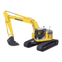
Komatsu PC360LC-11
516 pages
Komatsu PC360LC-10
31 pages
Komatsu PC360NLC-11
516 pages
Komatsu PC360LCi-11
376 pages
Komatsu PC308USLC-3E0
324 pages
 Loading...