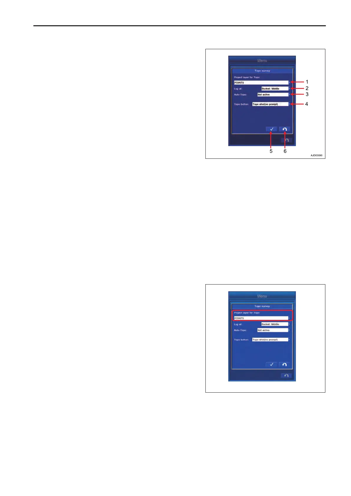
(1) “Project layer for Topo:”
Y
ou can set the layer to which the Topo survey point is saved.
(2) “Log at:”
You can set the bucket edge position for which the Topo survey
is performed.
(3) “Auto-Topo:”
You can switch the method of Topo survey between Manual
and Auto.
(4) “Topo button:”
You can set the method of data observation either single or
continuous.
(5) ENTER button
Tap ENTER button and the setting is saved.
(6) RETURN button
Tap RETURN button and the screen returns to the previous screen.
REMARK
For the method of the Topo survey, there are 3 types as follows.
• Not active
Each time “Topo Survey” button is pressed on the working screen, a single point datum is saved.
• Minimum horz. distance
Coordinates of the bucket edge position are saved continuously by each time the work equipment moves
for the set distance.
• Fixed time interval
Coordinates of the bucket edge position aresaved continuously at the set time interval.
METHOD FOR SETTING MANUAL TOPO SURVEY
METHOD FOR SETTING LAYERS
Tap “Project layer for Topo:” column, and select the layer to
which the Topo survey point is saved.
SETTING CONTROL BOX
7-133
 Loading...