1.
T
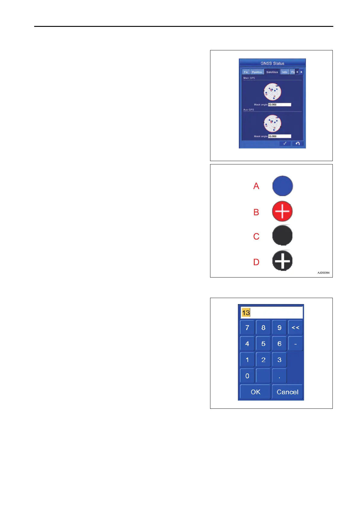
ap the “Satellites” tab to select.
(A) Blue: Indicates GPS satellite.
(B) Red cross: Indicates GLONASS satellite.
(C) Black: Indicates GPS satellite which cannot be ac-
quired.
(D) Black cross: Indicates GLONASS satellite which can-
not be acquired.
Mask angle
The angle (elevation angle) which GNSS antenna can communicate is displayed.
2.
Input 13 ° normally.
When
changing the setting, tap the numeric value. The nu-
meric keypad pops up.
A red circle indicates the range of communication. The
smaller the angle value of communication becomes, the
larger the range of communication becomes. Making t val-
ue larger narrows the range of communication.
NOTICE
The accuracy of bucket edge may be deteriorated if
the communication range of satellite is changed with-
out reason.
METHOD FOR DISPLAYING GNSS RECEIVER INFORMATION
It displays the information of GNSS receiver.
EXECUTIONS CHECK GNSS COMMUNICATION STATUS
8-45
 Loading...