METHOD FOR SETTING AUTOMATIC TOPO SURVEY (DISTANCE BASED)
METHOD FOR SETTING LA
YERS
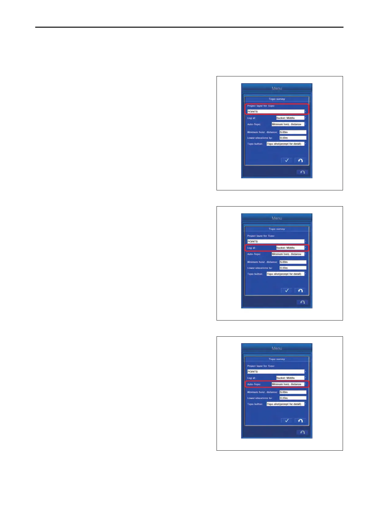
Tap “Project layer for Topo:” column, and select the layer to
which the Topo survey point is saved.
METHOD FOR SETTING LOGGING POINT
Tap “Log at:” column, and select the bucket edge position for
which Topo survey is performed.
“Bucket:Left”: Bucket edge at left end
“Bucket:Middle”: Bucket edge at center
“Bucket:Right”: Bucket edge at right end
“Left and Right Edge”: Bucket edge at both ends
METHOD FOR SETTING AUTO-TOPO (MINIMUM HORZ. DISTANCE)
To perform the automatic Topo survey (minimum horizontal dis-
tance), tap “Auto-Topo:” column, and select “Minimum horz.
distance”.
Coordinates of the bucket edge can be saved continuously
each time when the work equipment moves the set distance.
SETTING CONTROL BOX
7-135
 Loading...