USE OF TOPO SURVEY
The
current position can be measured by saving the position data of bucket edge. There are manual method
and auto method for measuring. A single data is saved in manual method, and a series of data are saved in
auto method.
For the position measurement, setting is needed at the beginning. For the details of position measurement, see
“METHOD FOR SETTING TOPO SURVEY”.
METHOD FOR PERFORMING TOPO SURVEY MANUALLY
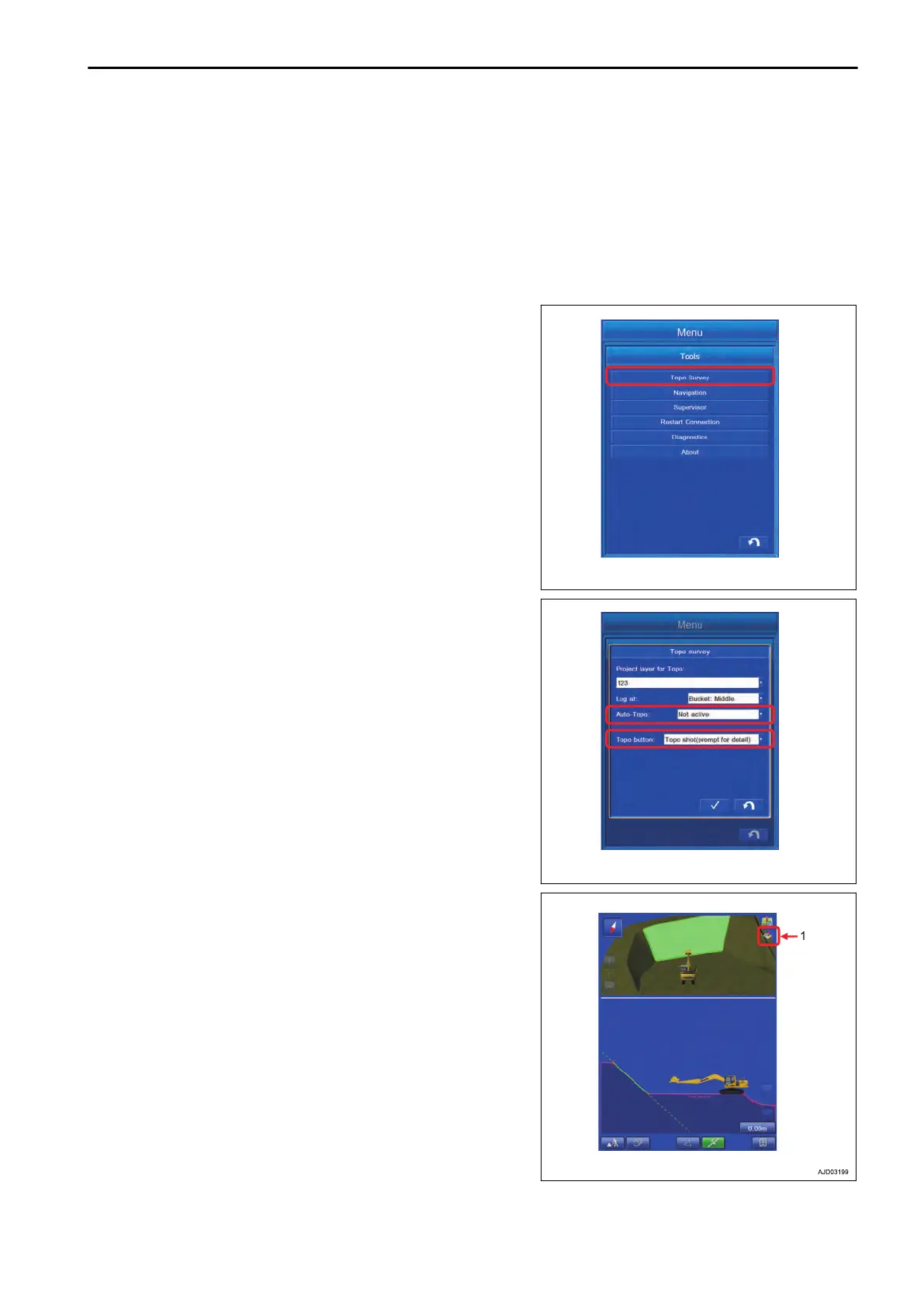
1.
Tap the “Topo Survey” button on the tool menu.
The display changes to T
opo Survey screen.
2.
Set the “Auto-T
opo” to Not active, and set “Topo button” to
“Topo shot(prompt for detail)”.
3.
Move the bucket edge to the desired point and tap the but-
ton (1).
EXECUTIONS USE OF TOPO SURVEY
8-49
 Loading...