Modify the map view
Tip: use thumb and forefinger.
—
Tap both fingers simultaneously on the map
and leave them on the screen.
—
To reduce the map view, move one finger closer
to the other. To zoom in on the map, move
one finger away from the other.
Tilt the map view
Tip: use your index and middle fingers.
—
Press both fingers at the same time and at the
same height on the map and leave them on the
screen.
—
To tilt the map view forward, move your fingers
upwards. To tilt the map view backwards, move
your fingers downwards.
Rotate the map view
Tip: use thumb and forefinger.
—
Tap both fingers simultaneously on the map
and leave them on the screen.
—
To rotate the map view, turn your fingers
clockwise or counterclockwise.
Saved
data
The infotainment stores certain data, e.g. frequent
routes and position data, to speed up destination
entry and optimise guidance to the destination.
Delete saved data
1.
Click
Basic functions Eliminate
usage
behaviour
.
—
Display of two navigation maps at the same time
(display and instrument panel).
—
Online map updates.
—
Personal destinations.
—
3D city maps.
—
Online traffic information, e.g. dynamic POIs
(points of interest) or traffic bulletins.
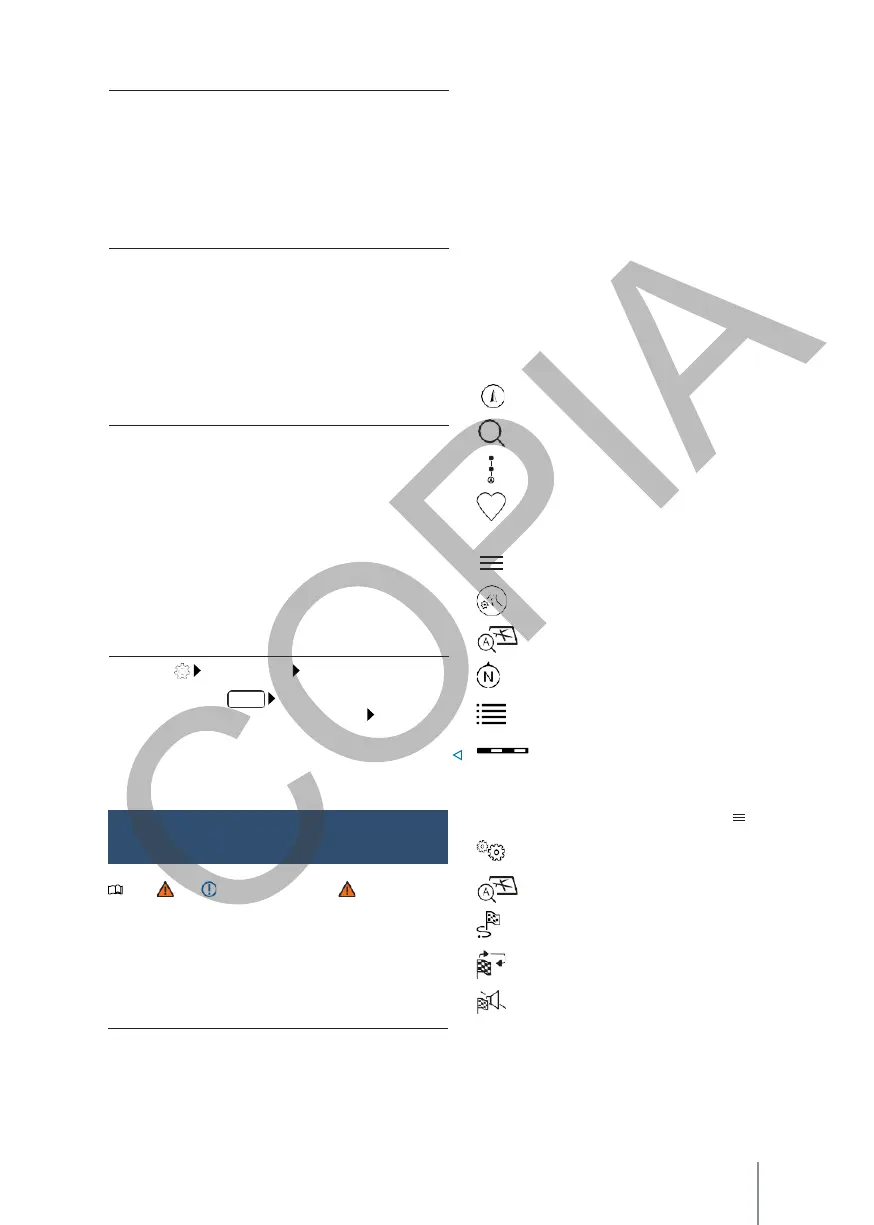
Symbols on the map
The function buttons and displays depend on the
settings and the current driving situation.
The map shows symbols for traffic reports and
points of interest (POIs), e.g. petrol stations,
railway stations or stages of interest, if these are
available for navigation → page 210.
Current position.
Destination search.
Destinations along the route.
Personal destinations (home address, work
address, points of interest (POIS) in the
vicinity).
Additional window with more options.
Additional window with route options. Centre
the map on the current position. Orient the
map to north.
OR:
press
use
.
Basic functions Delete com-
Information on the guide to the current
destination.
Map scale.
2.
Press confirmation to delete.
Note and , on page 186, and
, at the
beginning of this chapter, on page 206.
Navigation
Navigation functions are equipment- and country-
dependent.
Equipment
- Destination input and route calculation.
Symbols in the additional window
- To open the additional window, press .
Navigation settings.
Centre the map on the current position.
Route options and guidance information to
the current destination.
Repeat the last navigation voice-over. Volume of
the navigation locutions.
Equipment and symbols of the
nationality

 Loading...